GIS Technology Drives Campus Asset Management
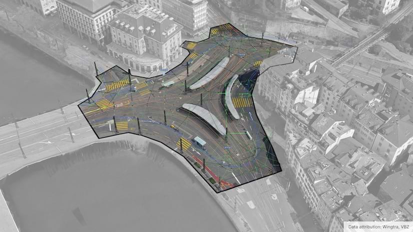
The facilities management team at a New York university uses GIS for outdoor and indoor asset management.
July 2025

The facilities management team at a New York university uses GIS for outdoor and indoor asset management.
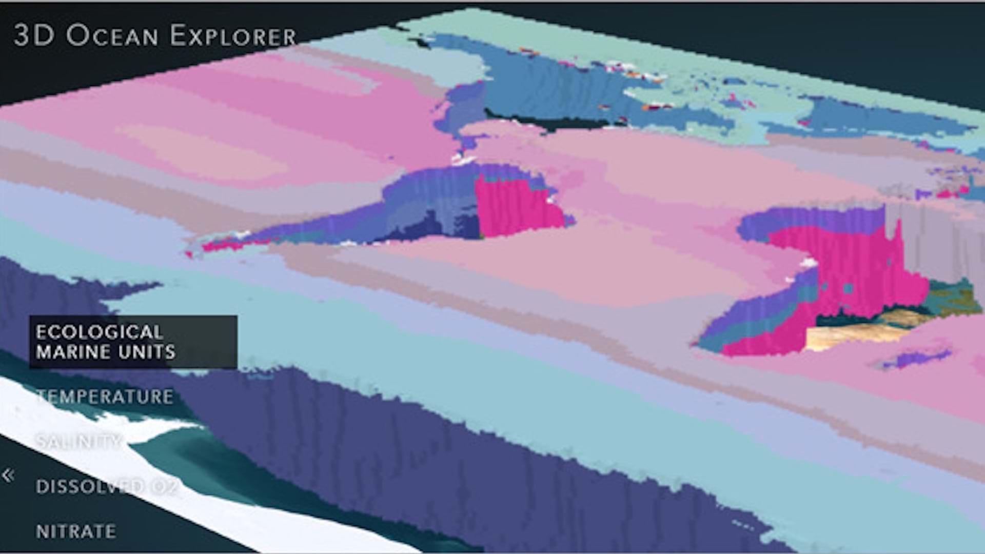
In this 10-minute tutorial, learn how 3D scenes and interactive controls allow for greater data exploration with the 3D Ocean Explorer app.
Scientists are using an AI-powered 3D model—an environmental digital twin—to protect this vital natural resource.
Matt Ball from Esri explains why drones are becoming an essential tool for local governments and businesses.
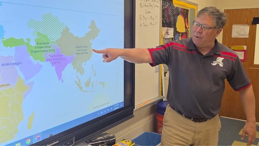
Chris Bunin, a high school social studies teacher in Virginia, uses ArcGIS to enhance instructional methods and engage students.
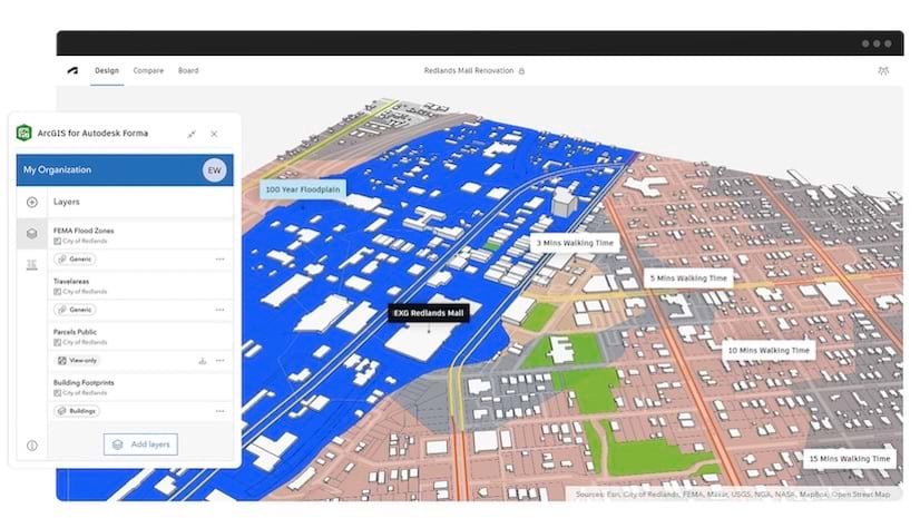
This new integration introduces Esri’s authoritative geospatial reference data into Autodesk Forma to transform design and planning.
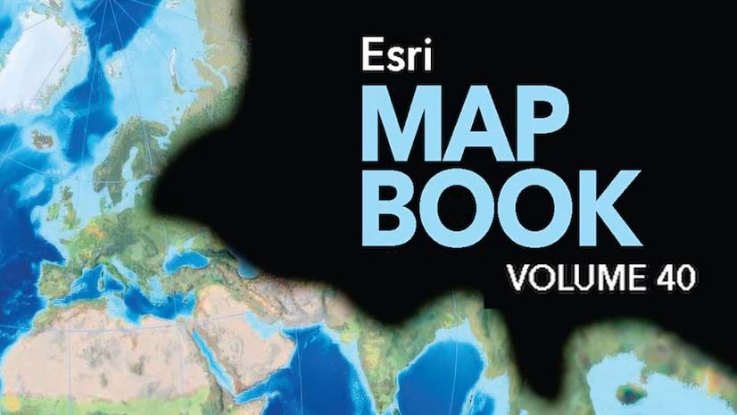
The annual book showcases the fascinating maps presented at the yearly Esri International User Conference Map Gallery exhibition.
Join cartographers, geographers, and mapping enthusiasts to share knowledge and celebrate the art and science of cartography.
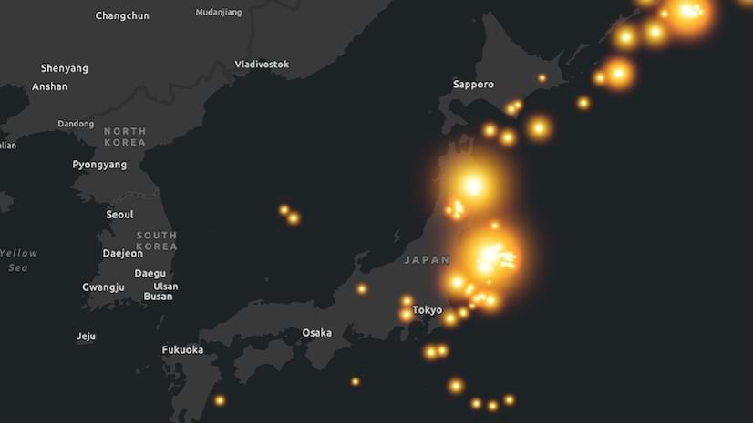
In this tutorial, learn how to use ArcGIS Pro to create a short animation of earthquakes in Japan.
The June 2025 update includes new capabilities in Map Viewer, user type updates, and streamlined analysis workflows with ModelBuilder.
Test new AI capabilities and provide feedback to transform how ArcGIS Pro users interact with spatial data, tools, and documentation.
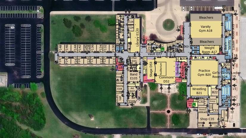
An indoor mapping system was developed for a high school in Fulton County, Illinois, to integrate with emergency response technology.
Denver transformed its printed stormwater drainage plan into an interactive online portal, making flood risk information easily accessible.
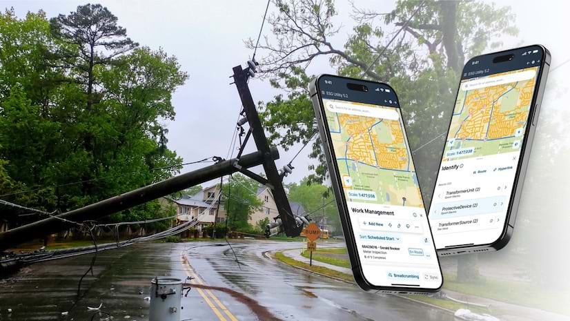
This electric utility created a central system of record with ArcGIS and a work management solution to better track storm damage.
In this free course, learn how the application of spatial data science uncovers hidden patterns and improves predictive modeling.
In this instructor-led course, learn design techniques and ArcGIS workflows to create and share professional-quality information products.
Learn how to structure a story, use maps to tell that story, and apply techniques to create an immersive experience in ArcGIS StoryMaps.