The Vault is Slate’s history blog. Like us on Facebook, follow us on Twitter @slatevault, and find us on Tumblr. Find out more about what this space is all about here.
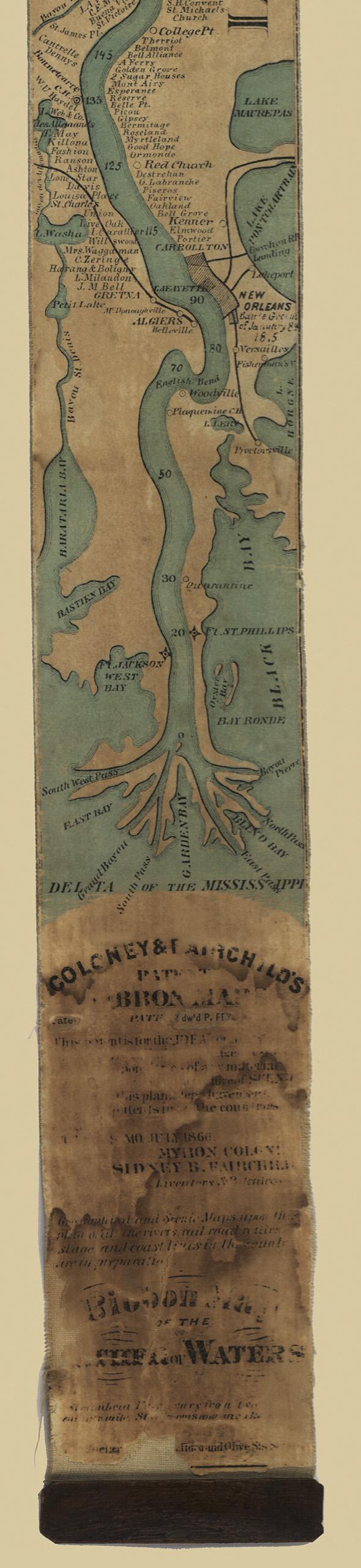
This 11-foot-long “ribbon map” of the Mississippi River, printed in 1866, was sold to people traveling on steamships along the “Father of Waters.”
By 1866, five decades after the first steamboat sailed down the Mississippi, the river’s banks were full of landmarks that people traveling north or south might want to identify. The map records state lines, settlements and cities, major tributaries and falls, and military forts. In the southern reaches, the cartographer notes names of individual plantation owners, including (right below Vicksburg) Jefferson Davis.
The ribbon map, patented by its inventors Myron Coloney and Sidney B. Fairchild of St. Louis, came in a cylindrical case. The paper was wound up inside the canister and pulled out by hand; the tourist wishing to return the map to the case used a metal crank.
The design, while appealingly gimmicky, had significant drawbacks in practice. “The lack of a take-up reel,” the Denver Public Library writes, “makes examination of longer lengths awkward.” Tourists could end up wrangling a fully-extended 11-foot map on the deck of a steamboat—not a pretty picture.
Courtesy Library of Congress