
1 August 2016
Third Severe Flash Flood In July Hits Maryland/Delaware
Posted by Dan Satterfield
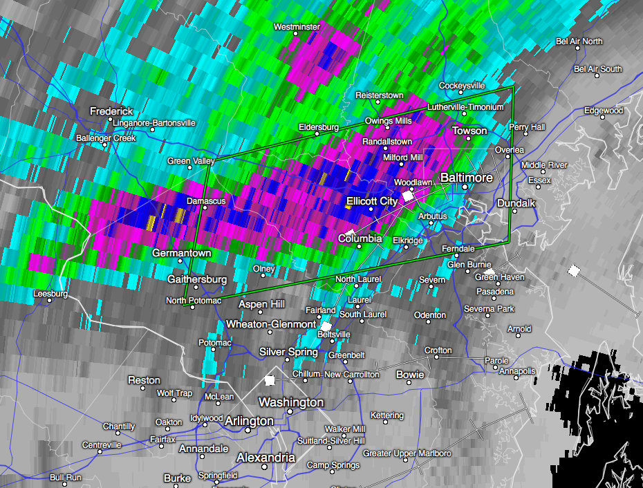
Radar estimated rainfall Saturday night near Baltimore. The radar indicated over 6 inches had fallen near Ellicott City. Image from Washington NEXRAD Doppler.
The month of July brought 4 major flash flood events to my area. One was very close with over 5 inches of rain where I live in Salisbury,Md. and over 7 inches just to our west. The other was near Seaford in Delaware (and extended into Maryland), and another just south on the Eastern Shore of Virginia, where over 9 inches of rain fell in Accomack County. Then came Saturday night, across the Bay, in historic Ellicott City, just west of Baltimore. Extreme rain events are WAY up over the last 50 years across the Northeast U.S. and the fact that the oceans are the warmest ever measured, are an obvious factor.
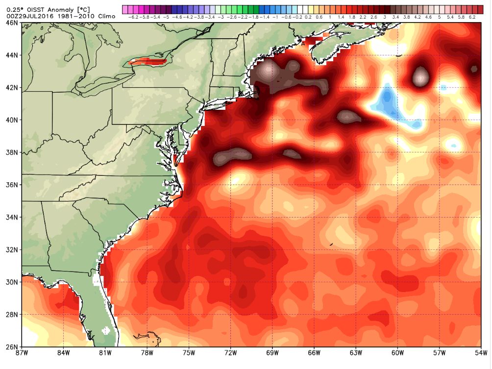
Notice how far above average the Atlantic sea surface temps are this week. It’s been that way for weeks and much of the last year.
Warmer oceans mean more water vapor in the atmosphere and when conditions are right for heavy thunderstorms, you can get some incredible rainfall totals. These sudden extreme flood events are nearly impossible to forecast temporally and spatially but there were clues in the special IR satellite imagery we use to look at water vapor in the atmosphere. The graphic below is courtesy of Sheldon Kusselson (NOAA retired) who is an expert in using water vapor imagery from satellites.
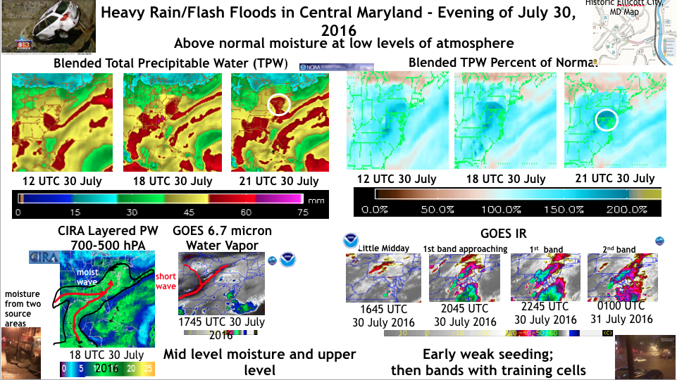
Click for larger version. Image from Sheldon Kusselson.
Below is a video posted on YouTube from Ellicott City as the flooding began. From my friend Sean Sublette at Climate Central- “According to the National Weather Service, 5.52” of rain fell in 90 minutes there, with more than half of it (3.16”) coming in the first 30 minutes. The storm total rainfall was 6.50″. The early analysis from the NWS suggests this rainfall rate has less than a 0.1% chance of occurring in any given year. Put another way, this is a rainfall rate that statistically occurs there less than once in a thousand years.”
 Dan Satterfield has worked as an on air meteorologist for 32 years in Oklahoma, Florida and Alabama. Forecasting weather is Dan's job, but all of Earth Science is his passion. This journal is where Dan writes about things he has too little time for on air. Dan blogs about peer-reviewed Earth science for Junior High level audiences and up.