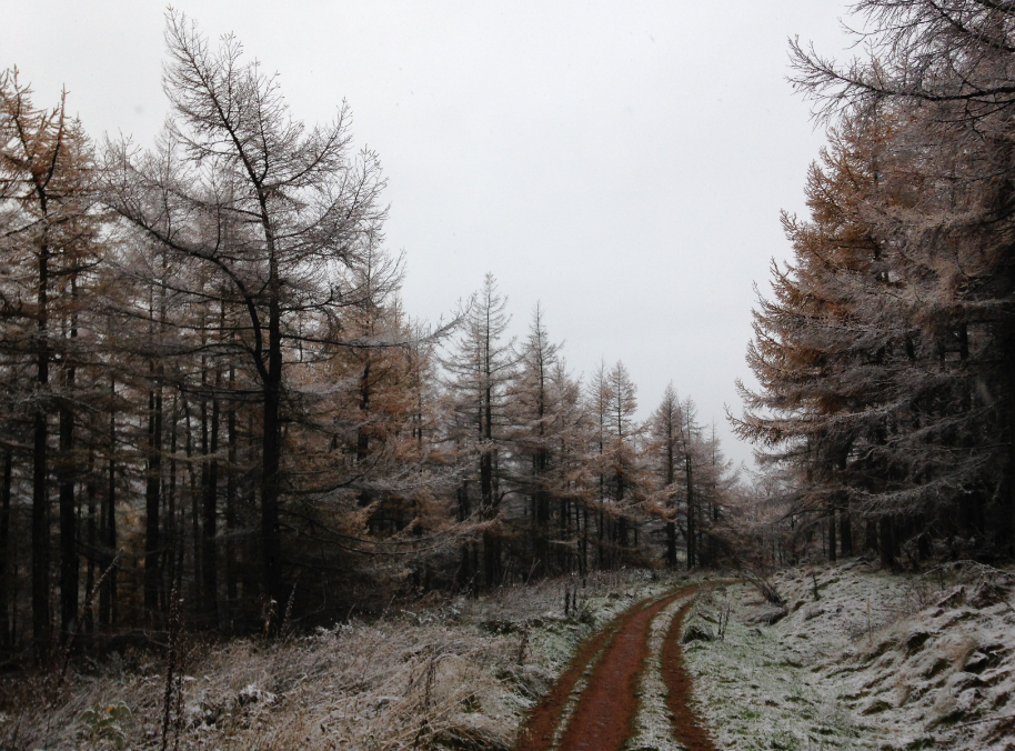
More snow heading down central and eastern Britain this morning, snow showers from the far NW too. It's cold and icy out there and severe flood warnings are resulting in evacuations in East Anglia
Yes, finally I have snow when I opened the curtains this morning, after nothing on Thursday. Yesterday’s snow showers came in from the NW hitting Scotland, N.Ireland, northern England and NW Wales with eastern Britain missing the worst of the wintry weather due to the wind direction. The waving front in the south, which had been such a tricky borderline forecasting situation, spent an agonising time as rain before turning to proper snow as it cleared to the SE and the really cold air took hold.
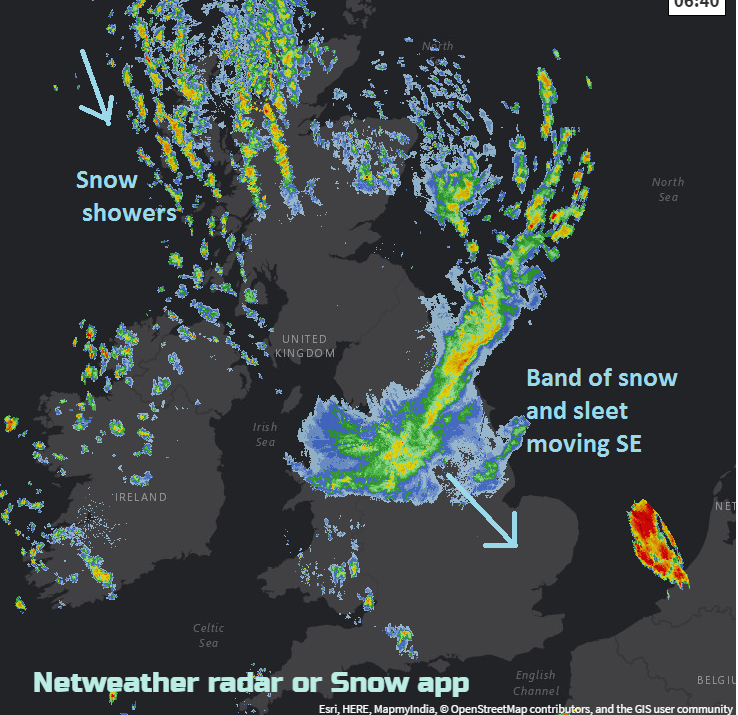
Overnight, a broad band of snow and sleet has moved down eastern Britain bringing the snow to more of the UK (including me whoooo!) It is now moving over Yorkshire, N .Wales towards the Midlands and East Anglia, heading SE but becoming patchier as it heads over Gt. London late morning.
It is cold out there, ice is a problem and it will feel bitterly cold in the wind.
Most areas will be feeling the brisk NW wind with strong to gale force winds along the east coast of England. There are already gusts of 50mph inland for England, and East Anglia will feel the brunt of these winds by lunchtime.
There is also the risk of coastal flooding today to add to the Friday the 13th list of severe weather. Low pressure is moving down the North Sea; this creates a bulge of water ahead of it in the southern North Sea. We have the push of the gales from the NW, and the environment agency have severe flood warnings as all of this coincides with High tides today. The severe flood warnings mainly affect Essex and Suffolk, but the whole of the east coast is dotted with warnings.
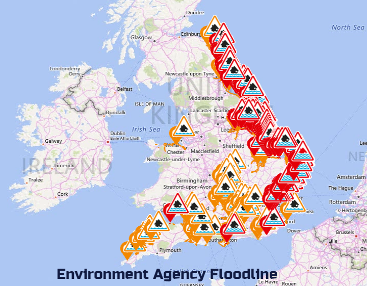
We are currently experiencing high tide levels due to a combination of spring tides and a tidal surge. The gale force winds will cause large waves and sea spray resulting in potential damage to flood defences and flooding of property. Hazardous conditions are likely and you are advised to take care near coastal defences and avoid coastal paths and promenades.
Today
Away from the eastern band of snow this morning, other parts of the UK still have a feed of snow showers from the NW, brought in on these brisk winds. There could also be hail the odd lightning strike too and sleetiness. There will be fine winter sunshine away from these wintry feeds. Temperatures will struggle today. 4 or 5C for southern Britain but you should add on the wind and sub-zero over the snow fields in the north.
Tonight
It will be cold again tonight with ice a problem once more. Most places will be at zero or below. The winds will ease off a bit, but there will still be enough of a breeze to make wind chill a problem. There will be a widespread hard frost. A line of snow showers will move in from the Atlantic over Northern Ireland and then Scotland during the night which will then affect NW England and northern Wales too. So, a bit more snow is possible from the NW as we head into the weekend.
Saturday
Another cold, frosty start with ice. There will still be the old NW wind, this eases for Scotland but will remain brisk over southern Britain until the evening. Midler air will begin to creep in from the Atlantic on Saturday as warm fronts bring more cloud and light patchy rain bands. SW Britain and Northern Ireland could feel okay at 6 or 7C whereas further east stays much colder all day.
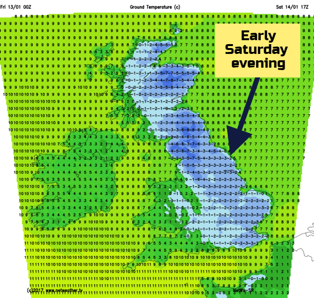
During Saturday evening, less cold air with a weather front will come in over the UK. It could come up against the lingering cold air which will again bring a frost over eastern Britain. So, there is the chance of more wintry weather for northern Britain, maybe the east too, but at the moment it looks like the snowfall should be over the hills and mountains of Scotland.
Overall the snow risk is fading this weekend, our wintry burst dissolving away.
Sunday
It could be a wet start on Sunday with the band of rain over much of Britain. Behind it will be milder air. There will be a lot of cloud, and it could be quite damp but a change in the feel of the air after the recent cold.
Next week looking more settled as pressure rises over the UK, with plenty of dry weather but night-time frost.