In order to evolve into the thinking, building, producing, consuming, ordering, planning, texting creatures we are today, we humans had to ride/pioneer into the unknown.
Complex culture depends on the exchange of everything, exchange depends on established connections, established connections depend on travel and movement—but barriers always exist. Wilderness, fearsome and hazardous, is among the most impressive and iconic of the barrier class. To tempt its transit can invite dire consequences, but it is in our nature as humans to push boundaries, to make discoveries, and to know the unknowable.
RELATED: We Tested the Most Adventure-Ready Bikepacking Gear
But why a bicycle? Why not a donkey, a motorcycle, a helicopter, a sailboat or a simple pair of hiking boots? Because bicycles are the most pragmatic/useful/efficient means of personal transportation ever invented, that's why! They cover ground at the ideal speed. They are dependable, simple, and adaptable. And they will carry everything you need them to carry: food, water, shelter, and yes, even entertainment such as a book and/or prosumer grade slingshot. (Discover 75 life-changing rides in The Cyclist's Bucket List, published by Rodale!)
Let’s consider the alternatives for a moment. Have you ever tried traversing a mountain? You might have to feed a donkey, put gas in a motorcycle, and do so-many-things to a helicopter that we don't have nearly the time or energy to enumerate. And yes, of course, we know what you're thinking, you're thinking what's wrong with walking, the old standby? Or, “hiking,” as it's known in adventure circles. It's too slow, that's what’s wrong with it.
Anyway, we (Yonder Journal) posit that bicycles are the perfect vehicle for experiencing the unknown world. They travel at the right speed—it's a scientific fact that 12 to 18 miles per hour is the optimal speed at which to view, engage with, and document the world—and they use the wheel, which, last time we checked sits in second place on the list of man’s best inventions.
To recap:
- You have to go places because it's in your nature and because civilization depends on it.
- Bikes are how you go places, unless you hate doing it right.
- And so now here we are. YOU ARE READY! You’re motivated and willing, ready to explore, discover, and pioneer in the wilderness—you know, up to a point.
But where should you go and how should do you do it? Don’t sweat it, we got you! Here are six rapture-producing bike rides in varying degrees of North America’s wilds. We've done them. We love them. We think you should do them. Here's the who, what, where, when, and why.
Old Ridge Road Permanent
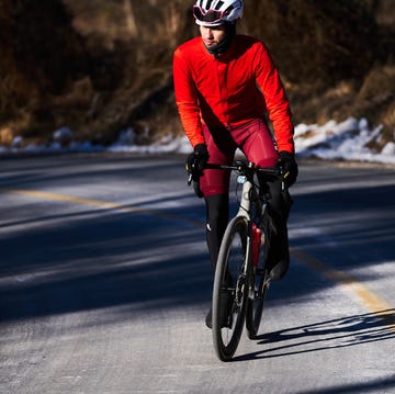
Discipline: road cycling, best executed as sunset racing and metropolitan escapism.
The Draw: the thrill of unpredictable earthquakes; the Californian culture dichotomy; the Traverse Range.
Logistics:
- Start: Golden Saddle Cyclery, Los Angeles, CA
- Finish: Ranch House Coffee Shop, Gorman, CA
- Distance: ~ 125 miles.
- Time: One long day.
Precautions: Beware of California drivers. Wear sunblock, even in the winter. Especially in the winter.
The Story: Los Angeles and Bakersfield—one a cultural producer, the other an agricultural nexus—are two seemingly disparate cities whose respective vibes are separated by the Transverse Range. To travel between worlds, a navigable connection was attempted early on with the construction of the Ridge Route: a road that at the time connected the small ranch communities north of Los Angeles, to Fort Tejon, and later Bakersfield. Time and technology however have found the route abandoned, as Interstate 5 relegated the Ridge Route to a historical fetish—a reverberation of a romanticized past that now only exists when we imagine it.
The Takeaway: Los Angeles is world renowned as a sprawling expanse of concrete, communities, and consumption. In the face of this, the Old Ridge Road route is notable in that it takes you from the heart of this mega city to a forgotten stretch of road where one rides through a sepia-toned experience of forgotten time.
The Cumberland Passage Permanent
Discipline: road cycling, with a helping of bike-pushing through the snow.
The Draw: Sheetz, railroad tracks, American Legion Posts.
Logistics:
- Start: Pittsburgh, PA
- Finish: Washington, DC
- Distance: ~340 Miles.
- Time: Two to three days.
Precautions: Don’t go during a hurricane. Enjoy the smooth surface of the Great Allegheny Passage instead—the C&O; path is in much worse condition.
RELATED: 4 Ways to Carry More Stuff on Your Bike
The Story: This route follows a set of transportation corridors that were integral to sustaining the fantastic industrial growth of 19th and 20th Century America. While it is a testament to Yonder Journal’s legacy of misfortune that our attempt at completing this ride occurred while Hurricane Sandy was subjugating the East Coast, reputable sources who have made the passage on non-hurricane days report back that the ride offers an abundance of non-disaster experiential stimulation and easily accessible resources.
The Takeaway: If you manage to avoid a hurricane, then you’ll be riding through what amounts to a 340-ish-mile diorama of American history. And guess what, this route is dead–DEAD–simple. Once you get on it all you need to do is ride, no turns necessary. Plus, there are ample places to bask in nature (Ohiopyle State Park) procure food (Sheetz) and shelter (Morguen Toole Company hotel) along the way.
Iron Pass
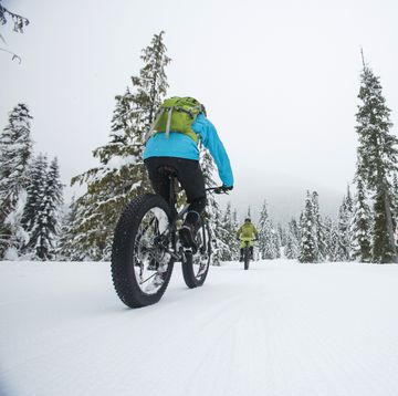
Discipline: Mountain fat-biking, floatplane riding, deep-backcountry wayfinding.
The Draw: Grizzly bears, sacred MTB lands, everyday a new pass, every moment an incredible view.
Logistics:
- Start: Tyax Cloud Camp, BC.
- Finish: Tyax Lodge, BC.
- Distance: ~70 miles.
- Time: Four days, four nights.
Precautions: Call up Tyax Adventures (which offers guided MTB tours as well as lodging) before you go; stay at Tyax Sky Cabin; bring bear spray.
The Story: BC is MTB hallowed ground. For the past few decades, big-travel mountain bikes have been de rigueur for shredding and blasting the well-known trails of BC’s coastal range and beyond. But BC is big, and the Chilcotins are mountainous with minimal access, rugged terrain, and hordes of intimidating animals enjoying seemingly endless wilderness.
Getting around here is difficult and road access is very limited—so we devised our route around floatplane access (offered by Tyax), a few established trails, and all-terrain-compatible bikes that would be capable of tackling a route that criss-crossed a long series of passes over four days and nights. Yes, being dropped off by a floatplane in the middle of nowhere in a sense means that we paid to be abandoned—but that abandonment makes the experience (if you survive) that much better!
The Takeaway: If you want full-blown backcountry bikepacking, it doesn’t get much better than this. Pack everything you need, leave everything you don’t, and prepare yourself for some of the best trails you’ll ever ride. Also be vigilant, as there are Grizzly bears all around; something has to guard these trails.
Mad Wikkid Bike Toouah
Discipline: Leisure bike touring, replete with bike-pushing up near-vertical hills, and spins past gourmet convenience stores, over marble sidewalks.
The Draw: Small-batch yogurt, quaint inns, green stuff, small-town artisanal Americana.
Logistics:
- Start: Brattleboro, VT.
- End: Montpelier, VT.
- Distance: ~220 Miles.
- Time: Four days, and three nights.
Precautions: Don’t miss the American Flatbread Inn or the Hoosac Tunnel. Beware of ticks and hauntings.
RELATED: What Happens When You Plan a Vacation to the Hardest Climbs in the World
The Story: When Yonder Journal asked our friend Benedict, aka Bene, aka the now-infamous Ultraromance, to organize a ride in the Northeast, he told us that without a question—without even an inkling of a doubt—the ride he’d be organizing would take place in Vermont, a state choked with artisanal grocery stores and co-ops. These repositories of crafted and curated foods are essential to keeping the body, mind, and spirit in tip-top condition, and there is nothing in the world more important to a brahman/bohemian/vagabond/aesthete like Mr. Benedict Wheeler than a tip-top bod and all the groupies and fringe benefits that come with it. Turns out the state has plenty to offer the willing cyclist: Preternaturally smooth dirt roads, haunted tunnels, and a wealth of wild camping and cabin options are just a few of the amenities that, taken together, will serve to WOW even the most calloused of bike tourists.
The Takeaway: What the mountains lack in elevation, they make up for in incline. The roads here are so steep, you might want to bring a climbing harness (JK or am I)? They’re also preternaturally smooth. Just about everywhere you look, you’ll find craft-level eating options. Plus the place simply oozes history.
Holing in the Mythical State of Jefferson
Discipline: Bikepacking, swimming, and casual touring.
The Draw: Experiencing what we’ve termed the Mythical State of Jefferson—occupying a little-traveled expanse between California and Oregon, Jefferson is a land of few people, much Bigfoot lore, hippies, libertarian recluses, hidden canyons, legendary swimming holes, and local watering holes.
Logistics:
- Start: Hayfork, CA
- End: Hayfork, CA
- Distance: ~100 miles.
- Time: Four days, three nights.
Precautions: Prepare for the heat by equipping with lots of water capacity; pack all your food, since there is no resupply along this route; and be extra careful to stay off any private property.
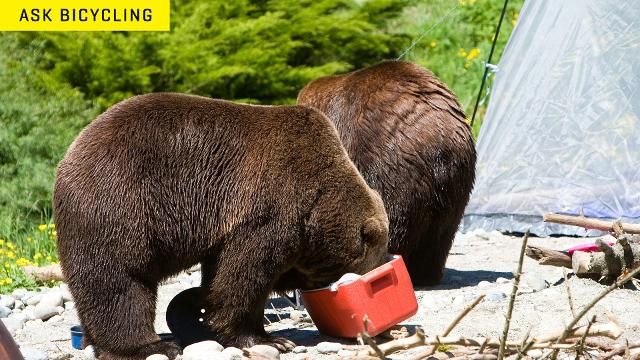
Don't venture too far before learning how to handle bears:
The Story: The point of this ride is not the ride itself; in this case, the bicycle is just a swimming hole delivery machine. Yes, you’ll be riding some lightly traveled singletrack and seldom used Forest Service roads, but that’s not what makes this route special. The goal here is to put you in a position to experience swimming hole after swimming hole after wondrous swimming hole along the south fork of the Trinity River. How did we stumble on this magical route? We have a local wizard whose research—combined with the internet, analog maps, personal experience, local hearsay, and a process of rational alchemy and intuitive witchcraft—helped create a ride that took us into the mysterious depths of Jefferson.
The Takeaway: If you’ve been searching for Bikepacking Shangri La, search no further. And be sure to bring a bathing suit—or not. Most likely there won’t be anyone around to care.
Elkhorn Crest Trail
Discipline: Mountain biking, bikepacking, overnighting, self-supported riding.
The Draw: Unadultered desert mountains, alpine isolation, and mountain goats, mountain goats, mountain goats!
Logistics:
- Start: Haines, OR.
- Finish: Haines, OR.
- Distance: ~ 50 Miles.
- Time: Two days and one night.
Precautions: You’re probably going to have to do some bike-pushing on the way down, when the trail turns into a miles-long boulder field.
The Story: Yonder Journal has spent years riding bicycles over diverse terrain in unique places, with the past two years devoted exclusively to this on a global level. We’d like to think of this as a good amount of experience with things farflung, and with that in mind we can say with confidence that the Elkhorn Crest Trail is the most distilled, zen, and focused version of a bikepacking route we’ve ever traveled.
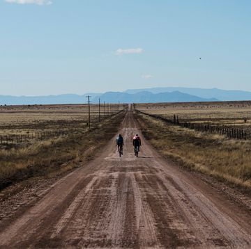
Taking place in the empty high desert of Eastern Oregon, this ride will have you cruising gravel jeep track, mountain-top singletrack, and lonesome rural roads. You’ll camp on the shores of alpine lakes shared only with flocks of majestic mountain goats. Most importantly for the busy modern human, this can all happen in the space of two days and one night. A WEEKEND!
The Takeaway: If you don’t have the luxury to take weeks off in pursuit of your cycling adventures, the Elkhorn Crest Trail is a ready-made highlight reel that will completely deliver on your wanderlust.
