Another mild day today, but colder air is on the way this week with frosts and wintry showers making a comeback.
If you thought you were safe to put away the winter clothes and turn the heating off for the season, think again, as the weather will be turning colder during the upcoming week, with some wintry showers and overnight frosts making a comeback.
We're not there yet, though, and it's still fairly mild across much of the country today with our unsettled and quite windy weekend continuing. The rain so far has mainly affected western and northern Britain, with the higher ground getting quite a soaking. Further south and east, it's been much drier with some parts getting away with no rain at all as yet, as the 24-hour rain accumulation map shows below.
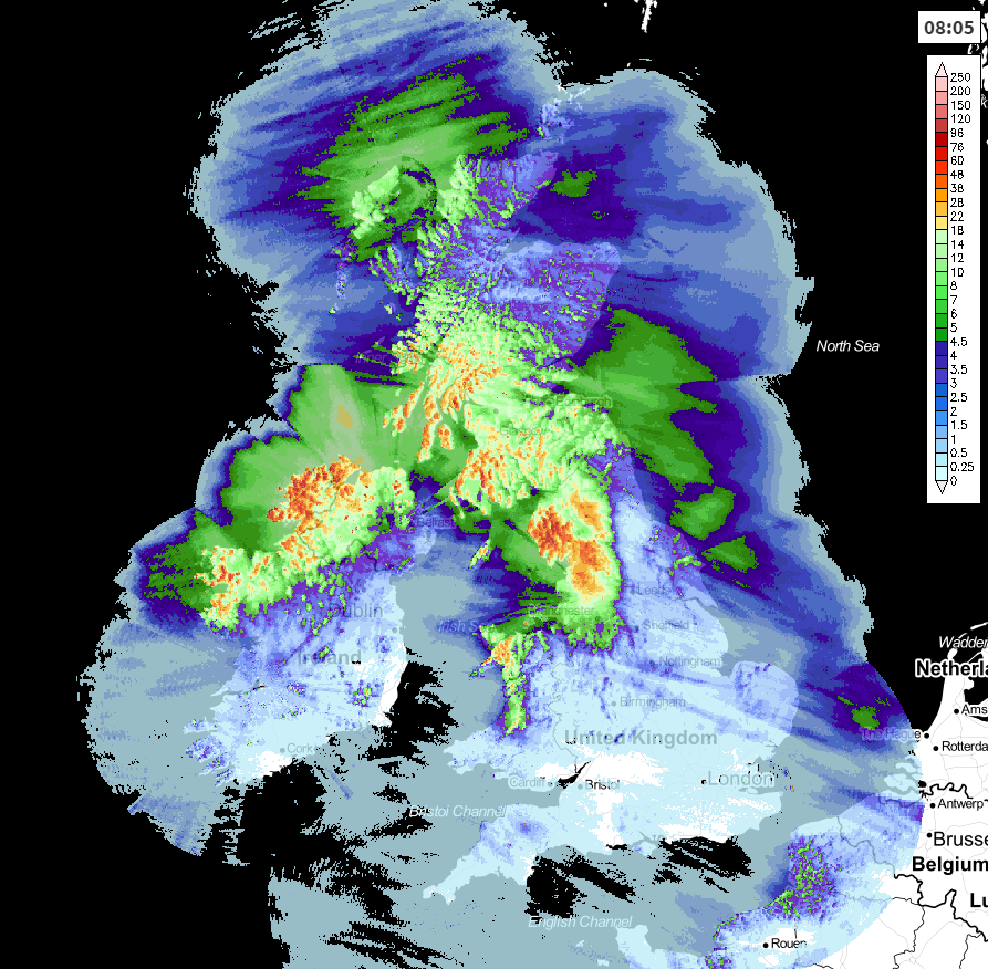
It's similar areas having a wet start to the day today as well, with a good part of Northern Ireland, northwest England, Southern Scotland and North Wales seeing the rain, with showers also affecting the far north of Scotland. Those showers in the north will spread southeast during the day - turning wintry up over the hills (good news for the Scottish Ski resorts). Having given the northwest another good soaking, the rest of the rain will edge southeast slowly, fizzling out as it does. That'll leave a good part of England and Wales with a mostly dry day, there'll be plenty of cloud about, but the odd sunnier spell isn't out of the question.
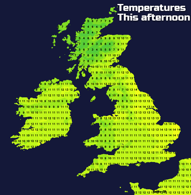
Temperatures today will range from a mild enough 13-15c in the east, cooler at 8-12c further west and north. What the thermometer says will be tempered a little by the wind though, and cooler air will be sinking south with the showers in the north.
Tonight starts with most parts generally dry, although those western facing hills are still likely to see some wet weather. The dryish start doesn't continue either with 2 areas of rain arriving later - one in the south, affecting southern England, and another further north, affecting the far north of England and moving up through into Scotland.
By Monday morning, the rain band in the north won't be too far off of clearing northeast Scotland, with sunshine and showers following behind from the west - these wintry up over the hills. The rain in southern England will keep coming during the day, it'll be patchy but with some heavier bursts at times. Best chance of staying dry will be in parts of the Midlands and northeast England.
Later on in the day, the rain in the south will clear and that'll then leave us all in a similar, quite chilly and showery boat. Many of the showers will be wintry overnight on Monday, with accumulating snow over the hills and mountains of northern Britain, as colder air spreads over the country.
Temperatures are likely to be cold enough for some frost and ice by Tuesday morning, then with low pressure and the colder air still in situ, an unsettled, chilly day follows. There'll be more rain, sleet and snow moving through - the wintriness mostly confined to the high ground in the north, though.
Another cold night follows - especially across the northern half of the UK, then Wednesday brings more showery rain, sleet and snow. Thursday should see the showers gradually easing down, but with clearer skies, there are likely to be some widespread overnight frosts as we end the week.