LINKED PAPER
Combining citizen science and weather radar data to study large-scale bird movements. Weisshaupt, N., Lehtiniemi, T. & Koistinen, J. 2020. IBIS. DOI: 10.1111/ibi.12906 VIEW
 Sophisticated tracking technologies enable the close monitoring of individuals of a growing number of bird species and have revealed amazing details of birds’ journeys, with little left to wish for. However, our understanding of bird migration as biomass fluxes, how birds react to ecological barriers and weather events, as well as studying the impacts of human infrastructure and land use on the birds’ lives has until recently been a jigsaw puzzle of assumptions and conclusions derived from small-scale to local research extrapolated to the birds’ migration systems. Large-scale species-specific solutions, providing a perspective closer to the birds’ perception of the world, are increasingly needed to support risk mitigation and conservation actions along migration corridors at appropriate scales.
In this context, weather radars (WR) have incited the interest of biologists in recent decades, given the worldwide distribution of these radars in large networks with overall about 1000 radars. They represent a unique opportunity to study simultaneously and continuously regional to continent-wide dynamics of aerofauna and to address concerns related to increasing human-wildlife conflicts in the air. There is just one major downside: weather radars are blind to species. Tools for the spatiotemporal validation of faunistic interpretations of weather radar measurements in situ are only sparsely available.
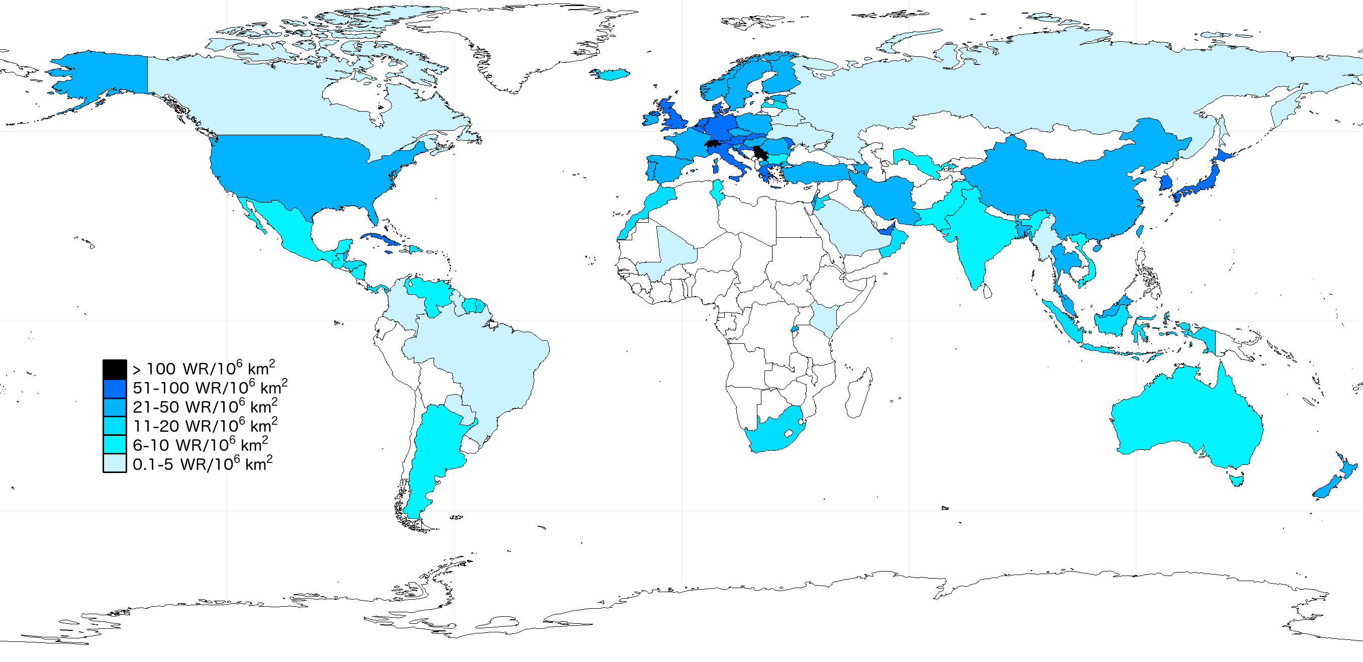
Figure 1 Distribution of weather radars in the world shown as radar density (WR/106 km2) per country.
Citizen science bird observation repositories established in the past 20 years have accumulated millions of entries of species-specific information across vast areas, e.g. about 18 million bird observations on the Swiss Ornitho, more than 21 million on the Finnish Tiira, about 54 million on Swedish Artportalen, and over 700 million on the global eBird. These databases hold not only recent observations, but also retrospectively entered ones, sometimes up to about 100 years back in time. Together with other citizen science data sources, these databases can relieve the taxonomic shortcomings of WRs and thus extend and refine the use of WR data, potentially providing large amounts of species-specific data in three dimensions in a short time at low or no cost. The uniformity of the US WR systems and open data policy certainly favoured the flourishing of WR ornithology in the US, with several published migration studies based on the US-American eBird and NEXRAD radars in the past decade. In contrast, in Europe the heterogeneity in quality, filtering of non-meteorological echoes, and availability of continent-wide data has hampered the process towards ecological applications until the previous decade. Looking at the Southern Hemisphere, WRs have not been used at all for the study of birds, even though bird echoes are also visible, for example in Australian WR data.
Recent advances in radar echo classification as well as increasing temporal and spatial coverage with high-quality data of both bird and weather radar observations sketch a promising picture of new opportunities. While current echo classification approaches most reliably work for nocturnal passerine migration evenly distributed in dry weather conditions (Dokter et al. 2019), current developments using additional cues available from dual polarisation technology will enable refined echo classification in a more variable meteorological setting and also types of migration, such as waterfowl or other diurnal migration. Some challenges will most likely remain unsolved – targets flying below the lowest radar volume measured and species identification.
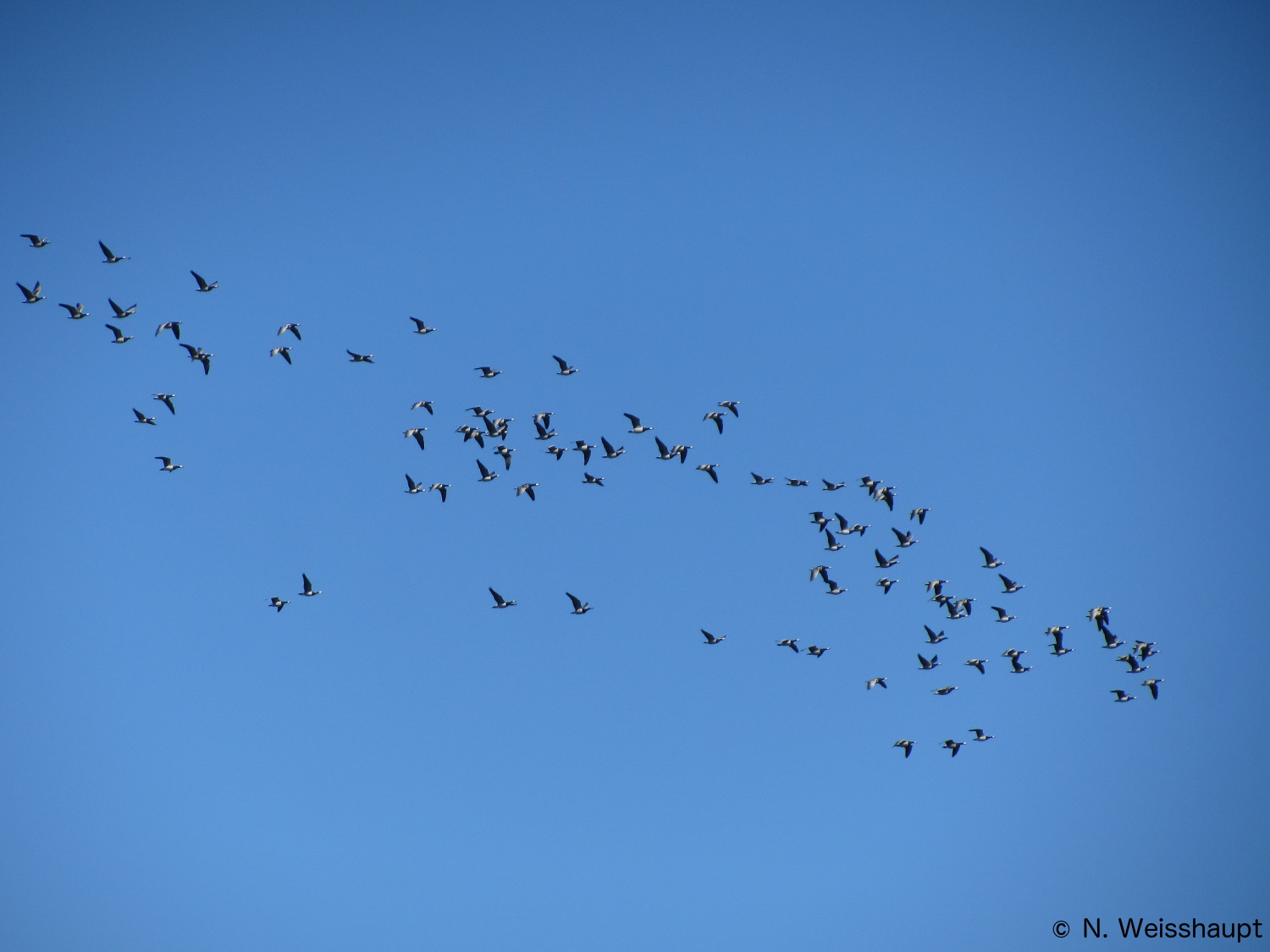
Figure 2 Waterfowl migration, such as the Arctic migration of Barnacle Geese and ducks, is often clearly visible on weather radar images. Echo classification based on dual-polarisation technology will potentially extend the automated extract analysis of bird signals to non-passerines in the airspace. © Nadja Weisshaupt
An approximate solution to these issues is available from bird sightings by ground-based observers, i.e. citizen scientists. Such data is theoretically available wherever a bird portal is at hand, i.e. globally (e.g. eBird) or from national platforms (e.g. Ornitho, Tiira, Artportalen, BirdTrack etc.). The best coverage with daily quantitative records of as exhaustive a species collection as possible is to be expected in highly populated areas and at relatively easily accessible sites of elevated ornithological interest in the respective season.
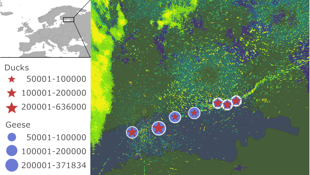
Figure 3 A weather radar image is overlaid with citizen science observations in the Gulf of Finland during strong waterfowl migration on 17 May 2017.
So far, examples combining citizen science data and weather radars in the US have involved studies of roosting behaviour, bird collisions with infrastructure and aircrafts, forecast models and conservation. In the near future, the joint citizen science-weather radar studies are expected to extend their fields of application and thus also the portfolio of services for various stakeholders requiring bird-related information, e.g. in the wind energy sector, bird strike committees and so on. Besides, improved (bird) echo classification triggered by radar ornithology will support the quality of meteorological products.
The interdisciplinary research group from the Belmont Forum/BiodivERsA research project GloBAM (Monitoring, understanding and forecasting global biomass flows of aerial migrants) is making efforts to advance the use of WR data in biology amongst others in combination with citizen science data. Its objective is to use weather radar data to study the biomass flows of aerial migrants (birds, insects and bats) from regional to continental scales in both Europe and the US.
References
Dokter, A. M., Desmet, P., Spaaks, J. H., van Hoey, S., Veen, L., Verlinden, L., Nilsson, C., Günther Haase, G. Leijnse, H., Farnsworth, A., Bouten, W. & Shamoun-Baranes, J. 2019. bioRad: biological analysis and visualization of weather radar data. Ecography 42: 852–860. VIEW
GloBAM partners. GloBAM – Monitoring, understanding and forecasting global biomass flows of aerial migrants. VIEW
Nilsson, C., Dokter, A. M., Verlinden, L., Shamoun-Baranes, J., Schmid, B., Desmet, P., Bauer, S., Chapman, J., Alves, J. A., Stepanian, P. M., Sapir, N., Wainwright, C., Boos, M., Górska, A., Menz, M. H. M., Rodrigues, P., Leijnse, H., Zehtindjiev, P., Brabant, R., Haase, G., Weisshaupt, N., Ciach, M. & Liechti, F. 2019. Revealing patterns of nocturnal migration using the European weather radar network. Ecography 42: 876–886. VIEW
Image credit
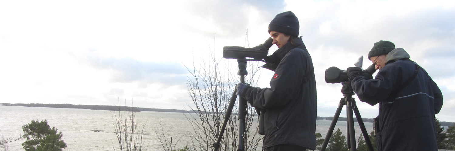
Top right: Birdwatchers aka citizen scientists © Nadja Weisshaupt
If you want to write about your research in #theBOUblog, then please see here.