In India, some 50 million hectares of land, an area the size of Kenya, is classified as “wastelands and degraded lands”—a holdover from a colonial land management philosophy that fails to serve the one-in-four rural villagers who live in extreme poverty. While they depend on these wastelands for their day-to-day existence, the government has long deemed these large swaths of land unworthy of investment.
Foundation for Ecological Security (FES) works towards both nature conservation and poverty alleviation by helping villagers secure property rights and develop systems that value the commons—a thoughtful transformation of these abandoned lands into community-controlled engines of livelihood. FES also puts mapping technology into the hands of villagers to help them assess and manage these so-called wastelands.
“There are centuries of rural wisdom in managing these resources,” said Jagdeesh Rao, Chief Executive of FES. “We transfer ownership of these lands back into the villages as common property to restore these degraded ecosystems.”
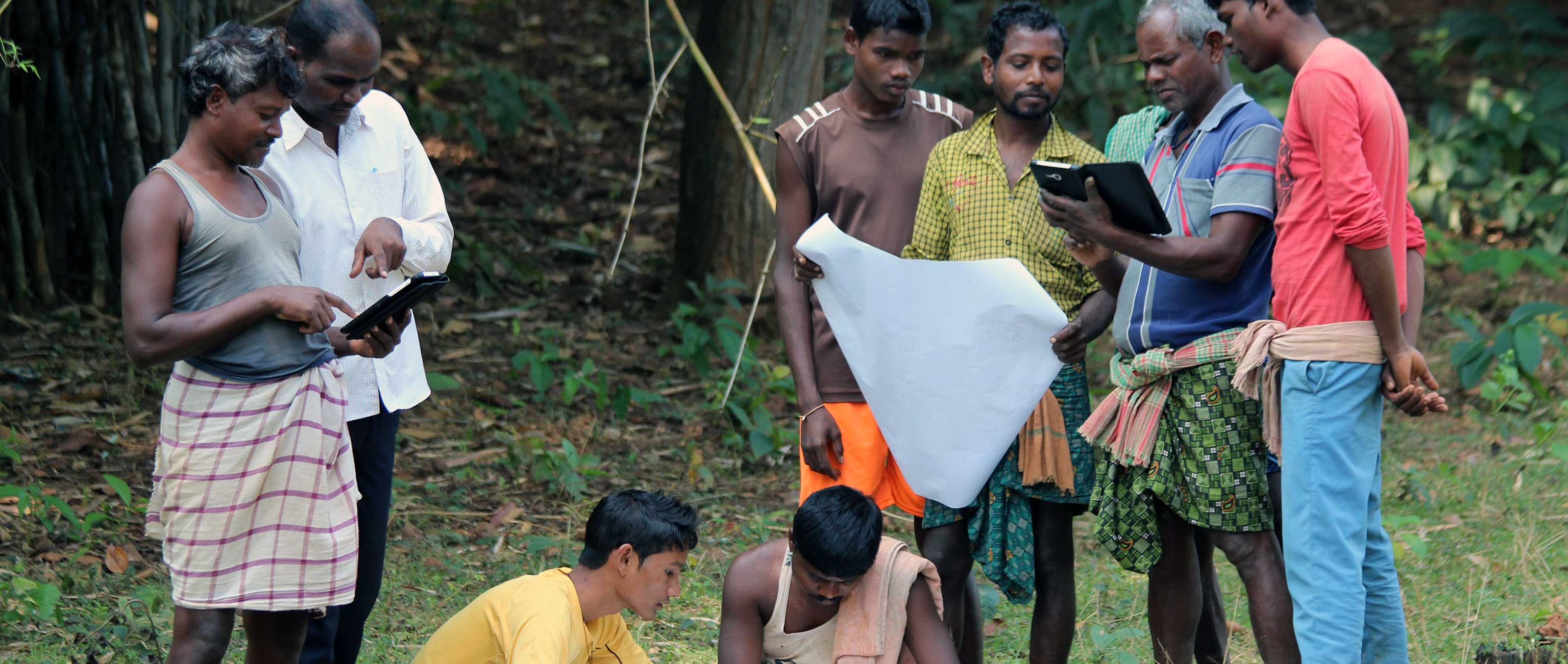
FES harnesses the faith and collaboration embedded in the social fabric of these villages and builds a connection between local leaders and government officials. Ubiquitous mobile technology and public data have helped FES scale their work. FES’s Composite Land Assessment and Restoration Tool (CLART) is an open-sourced geographic information system that aggregates all publicly available data about a given plot of land onto a mobile device to help local people manage their resources and ecology.
In Chikkaballapur district, about 100 kilometers north of Bangalore, village people use this technology to make informed soil and water conservation plans. This is rocky land where water is quite scarce. With the CLART technology, villagers can easily assess key features of the land like slope, rock type, porosity, and permeability. CLART deftly collates publicly available data from the National Remote Sensing Centre, the Geological Survey of India, and United States Geological Survey for practical local use by even semi-literate villagers—it’s data, democratized. CLART even calculates the approximate cost of land improvement projects.
 On the strength of a memorandum of understanding with the government, FES has introduced their CLART technology throughout the state of Chhattisgarh, including training government engineers. The government of Maharashtra also plans to scale up the use of CLART across that state. FES is also working with the National Remote Sensing Centre to scale up the nationwide use of CLART with the help of their national database and Android-based applications.
So far, FES has helped Indian villagers reclaim two million hectares of wasteland. Jagdeesh has set a goal of 10 million hectares over the next five years. “We will have to reposition village people as equal citizens of their country,” said Rao. “They are determinants of their own lives.”