Wam humid air hangs on for the London Marathon but rain from the west brings a change to the weather across the UK. Cooler and fresher next week.
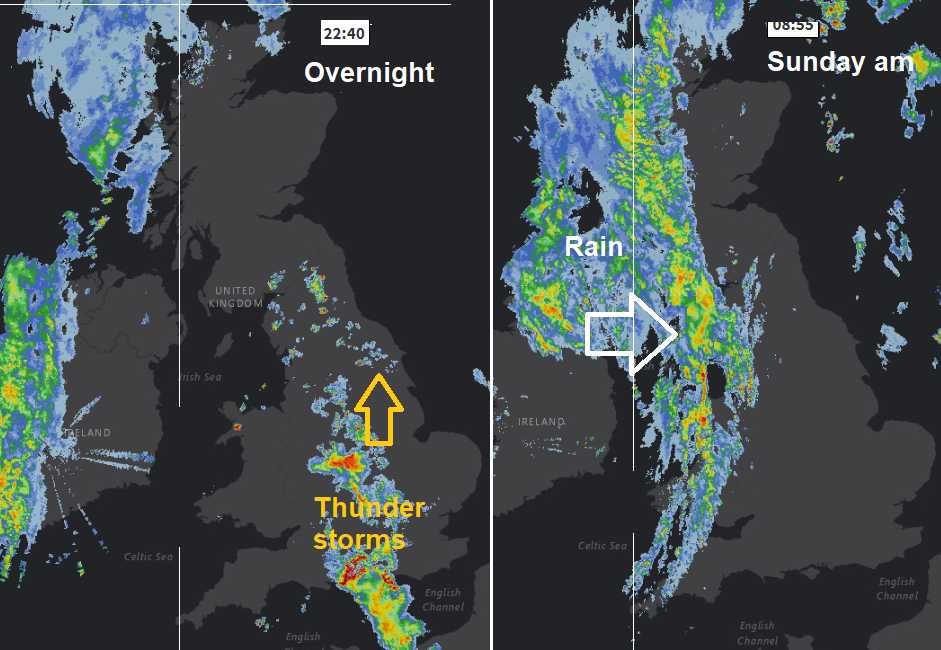
That was a lively weather night, after the recent heat. Heavy thundery showers gave a stunning lightning show as they moved from the English Channel northwards yesterday evening and overnight. Clipping SE Wales, marching up through England towards the North Sea with other lines appearing further north, from the Cumbrian Fells over the Pennines and Southern Uplands. Many areas missed all the rain or could just hear/see the thunderstorms in the distance. All that action was within a fading warm sector with the low centre away to the NW of the UK. Heading in now from the west is a cold front and occluded front, bringing a band of rain from the Atlantic.
So, we have two areas today separated by the frontal rain. One warm, humid air ahead of the rain band with sunshine, moderate to high UV values. The other more cloud, with outbreaks of showery rain and fresher, cooler air and a freshening westerly wind.
So sunny, dry, warm and humid for the London Marathon, could be the warmest on record with temperatures of 19 to 23C after a winter of chilly training.
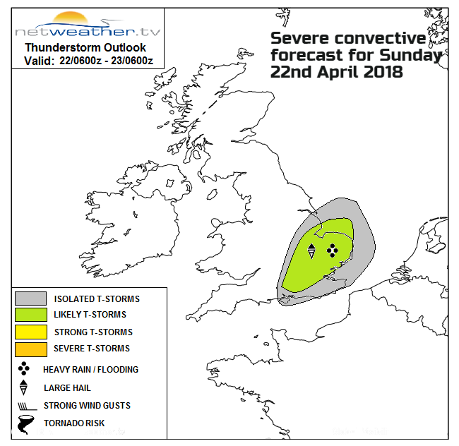
The radar shows that the rain band is already over Wales and NW England, so faster than on the model frames so if you are looking at an hourly forecast or just app output do adjust for that if you have plans today. The rain will reach eastern Scotland and northeast England around lunchtime then head off into the North Sea. Not such a distinct feature over southern Britain but Nick Finnis has issued a Severe convective forecast: (for further details click the image below)
Warm, humid and unstable airmass will hang on across SE England and E Anglia into the afternoon, - which may trigger isolated thunderstorms with surface heating.
Temperatures today – central and eastern England will see high teens to 22 or 23C, further west and for Wales low to mid-teens. Similar for Northern Ireland and Aberdeenshire and feeling quite cool in the breeze.
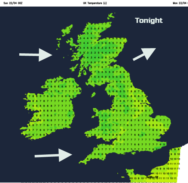
Throughout this evening and overnight the cooler air will be over all of the UK, with a westerly wind, a scattering of showers in the northwest and a very different feel to things for London and SE Britain
Outlook
During next week we keep the westerly Atlantic flow with temperatures around 9 to 15C. It looks colder from Thursday onwards including next weekend. April is such a fickle month.