


Cloud and rain clearing southwest to brighter and drier conditions today. Most areas becoming dry and settled from Friday and through the weekend, as high pressure builds.

Wednesday saw a slow-moving area of low pressure over Wales, which brought outbreaks of rain affecting many areas away from the far north, with snow over northern hills. Low pressure has moved south since yesterday, but weather fronts still bring rain this morning across parts of the UK. However, the rain will eventually fizzle out through the morning and the outlook is for the cloud and rain to become confined to the far south before eventually all areas turn dry by the weekend, as high pressure builds.
For now, it’s a cloudy but chilly start across much of England, east Wales and southern Scotland – with some outbreaks of rain in places, falling as sleet or snow over higher ground in the north, though there is some drier and brighter conditions spreading in across eastern England. However, across northern Scotland and west Wales we’ve seen clearer skies overnight – which has allowed temperatures fall below freezing, with temperatures falling as low as -5C in the Highlands and -3C across west Wales. So it's a cold start here, with a risk of ice to watch out for.
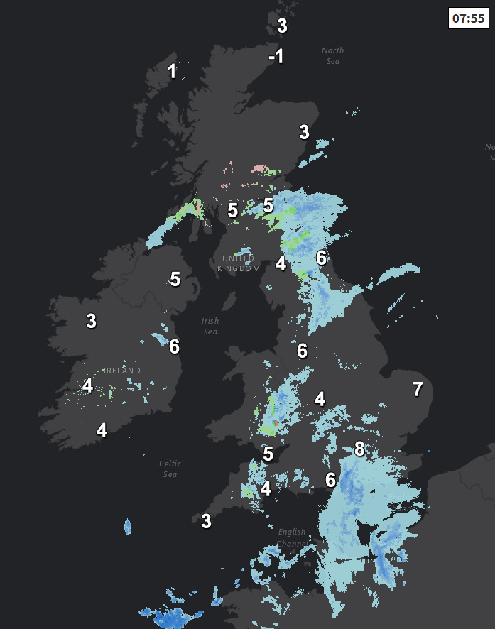
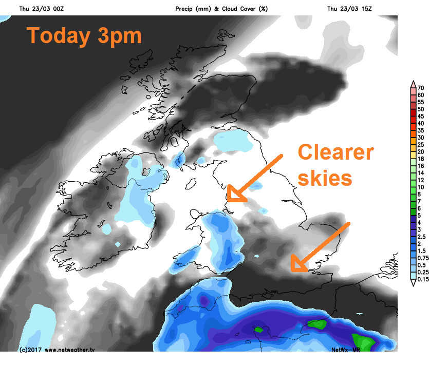
Through the day, the outbreaks of rain this morning will tend to clear southwestwards, though Wales, southern and western counties of England will stay cloudy and damp for much of the day, with further outbreaks of rain. Drier and brighter conditions spreading from the northeast across much of Scotland, northern and eastern England later this morning and into the afternoon, but accompanied by a chilly northeasterly wind.
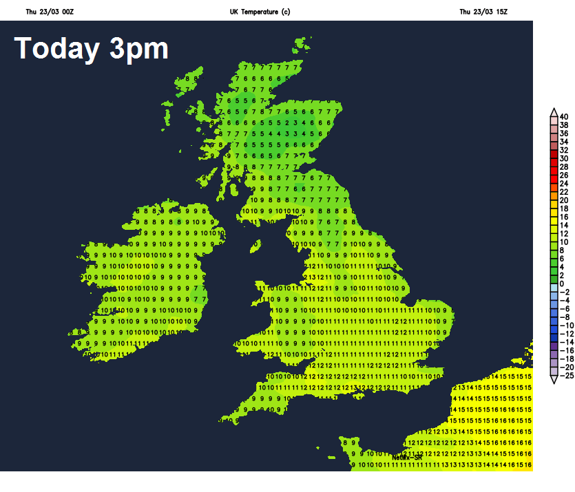
Temperatures reaching 7-10C in the north, 10-13C in the south.
Through this evening and overnight, remaining cloudy, damp and breezy along southern counties of England. Further north, lighter winds and clearer skies will lead to a cold night with frost in places by dawn.
Then for Friday, cloudy with some patchy rain or drizzle across southern most counties of England first thing, which will tend to clear away during the morning. Otherwise, most areas will be dry and bright or sunny after a chilly start. Best of the sunshine across central and northern areas. Cloudier with drizzle across the far north of Scotland. Temperatures reaching 10-13C generally with light winds, though still a chilly easterly breeze across the far south.
Through the weekend, high pressure remains in charge of our weather, so remaining fine and dry across all areas. Saturday will probably be the sunniest day though, after a chilly and perhaps frosty start, temperatures rising to 13-15C in the sunshine. More in the way of cloud perhaps on Sunday across more eastern areas, with the best of the sunshine across the west. A brisk easterly breeze towards southern areas both days taking the edge of the temperature too.
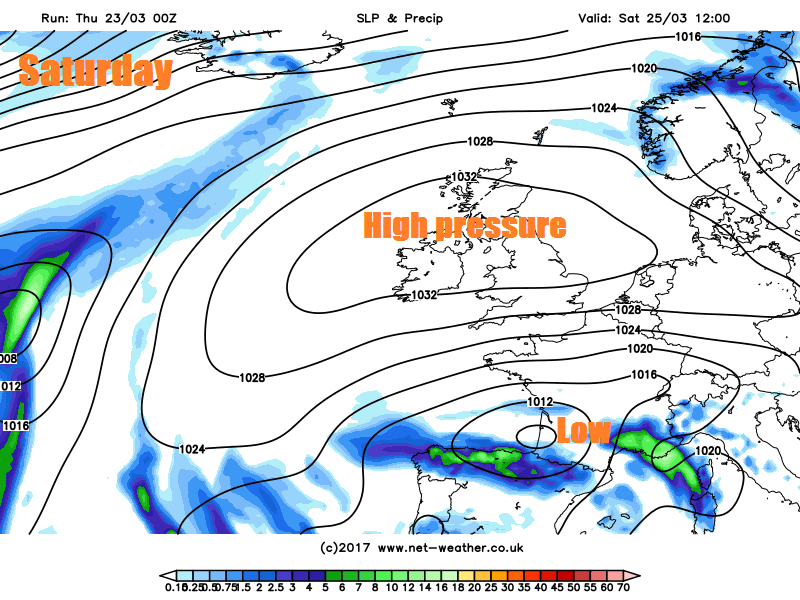
High pressure looks to remain on control for the first half of next week, bringing dry and fine weather with sunny days but chilly nights. Then high pressure looks like retreating east onto the near continent, which may allow unsettled and windier conditions to return off the Atlantic across the far west initially, then perhaps all parts by the end of the week.


