The Minnesota Pollution Control
Agency (MPCA) received $2 million less than requested in legislative funding
this year for the fiscal year 2016-17 biennium, leading to delays in some
watershed work. The agency was on track to monitor and assess Minnesota’s 80
major watersheds on a 10-year cycle. That timeline now shifts to a 11-year
cycle because of reductions in summer help, full-time staff, and aid to local
partners.
Less funding means less monitoring
will be done each year. Also, the agency has fewer staff members and contactors
to work on developing strategies to restore and protect water bodies.
Called the watershed approach, the
cycle consists of:
-
Monitoring and assessing rivers and
lakes in major watersheds to see if they meet water quality standards.
-
Identifying stressors to water
quality and conditions fostering healthy waters.
-
Developing Watershed Restoration and
Protection Strategies (WRAPS) to restore and protect water bodies.
-
Implementing projects and activities
to restore and protect water quality.
Cycles are staggered with an average
of 8 watersheds beginning a new cycle each year. With the funding shortfall,
the following watersheds will see a delay of 1 to 2 years in monitoring and 6
months to 1 year for their strategy development:
-
Rapid River
-
Redwood River
-
Cottonwood River
-
Rainy Lake
-
Lower Rainy River
The following watersheds will see a
delay of 6 months to 2 years for their strategy development (WRAPS):
-
Snake River (Red River Basin)
-
Upper/Lower Red Lakes
-
Otter Tail
River
-
Watonwan River
-
Minnesota River - Mankato
-
Des Moines River
-
Lower Minnesota River
-
Minnesota River Headwaters
-
Lac Qui Parle River
-
Nemadji River
-
Lake Superior South
-
Lake Superior North
-
Cloquet River
-
Vermillion River
With this plan, the MPCA is striving
to minimize disruption to local projects and to complete the first cycle in all
80 watersheds before starting the second one.
For more information about the
watershed approach, visit the agency
website or contact Glenn Skuta, statewide water monitoring
supervisor, at 651-757-2730.
Related information:
|
Small
ponds could make a big difference to the Le
Sueur River and downstream waters.
Holding
back water in small areas of farm fields for five to 10 days after rain would
make a big difference to the river, according to Patrick Belmont, an assistant
professor at Utah State University who has studied the Le Sueur watershed for
several years.
Holding
that water would reduce the peak flows in the river system, helping prevent
erosion that is degrading the water and the life within it.
“That
five to 10 days is the Goldilocks time where you reduce sediment and also
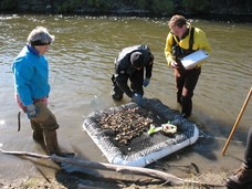
phosphorus and nitrogen,” he told 50-some citizens and landowners at a meeting
in Pemberton in southern Minnesota this summer (photo above right). The meeting was held by the Le
Sueur River Watershed Network, whose members started meeting in 2012 and
developed seven recommendations for a healthier watershed.
“This
place is not going to turn back into tall grasses and prairie,” Belmont said.
“But we can use a small portion of the land – 4 to 5 acres per field – for five
to 10 days to reduce sediment.”
That
reduction could be 50 to 75 percent of the sediment load hurting the Le Sueur,
the Minnesota River and waters further downstream.
“A
small fraction of the landscape could get us there,” Belmont said.
The
idea met with some concern from farmers and landowners about taking land out of
production. Belmont encouraged landowners to be proactive, decide on incentives
they need to set aside land, and seek support for them.
Read the
full
story about the river and the researcher on the MPCA website.
Related
report:
|
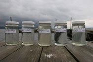
The MPCA is asking
for your data to help assess the condition of lakes and streams and build a
national database of water quality.
The MPCA is
specifically interested in the following priority watersheds because we will be
determining whether these water bodies meet state water quality standards in
early 2016:
- Clearwater River
- East Fork Des Moines
River
- Lower Des Moines
River
- Lower Minnesota River
- Rainy River –
Headwaters
- Red River of the
North – Marsh River
- Upper/Lower Red Lake
- Wild Rice River
The MPCA is also
looking for data on the Minnesota River from the headwaters to the Mississippi
River.
If you have data from
outside a priority watershed or one of these areas, the agency will also accept
it.
The MPCA will use your
data to:
- Help plan for future
monitoring efforts including what to monitor for and where to monitor.
- Identify pollutant “stressors”
that are causing or contributing to problems or threats to fishing, swimming,
and recreational uses.
- Evaluate the success
of ongoing activities to protect and restore water quality.
Deadline: Submit project, lab, and field data now through Nov. 2.
Deadline: By Dec. 15 you will need to review the data
entered by the MPCA.
Find out more on the MPCA's
surface water data website.
Your role in
collecting these data is important to Minnesota’s effort to identify impaired
waters, as well as those waters in need of additional protection. Thank you for
your help.
For more information
on submitting data:
- Nancy Flandrick, 651-757-2361
(St. Paul, Duluth, Rochester, and Mankato regional offices)
- Jean Garvin, 651-757-2378 (Brainerd, Willmar,
Marshall, and Detroit Lakes regional offices)
For more information
about how we use your data to assess lakes and streams see the MPCA’s
water quality assessment website.
|
The Request for Proposal (RFP) process for the
Watershed
Pollutant Load Monitoring Network (WPLMN) is now open. Agreements/contracts under this program are financed
through the Minnesota Clean Water Fund as established by the Legacy Amendment.
The MPCA will award up to $1.5 million in two-year terms with
the option to extend an additional two years. All proposals must be submitted through the SWIFT
e-supplier portal and must be received no later than Oct. 13. Proposals received
after this deadline will not be considered. Date is subject to change. Please
check the SWIFT Event for any updates to submittal date.
Proposers must have a SWIFT Vendor ID and
Supplier Portal Account to access the RFP and apply for WPLMN funding. Detailed
registration directions are available on the SWIFT e-supplier portal. Proposers should
be aware that it can take several days to receive a required Vendor ID from
SWIFT. If you need technical assistance for the SWIFT e-supplier portal, please
contact the SWIFT helpdesk line: 651-201-8100, option 1.
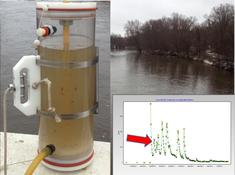
The
primary objective of the WPLMN is to obtain spatial and long-term pollutant
load information from Minnesota’s rivers and streams. Eligible entities
include:
- Soil and Water Conservation Districts
- Watershed Districts
- Regional Planning Organizations
- Watershed Management Organizations
- Local government units (LGUs such as
counties, cities, townships, and Lake Improvement Districts)
- Regional governmental groups
- Joint powers boards
- Minnesota colleges and universities
- Nonprofit organizations
- Native American tribal governments
This
RFP seeks local partners to collect water quality data at select sites in the Red
River, Minnesota River, Upper Mississippi River, Rainy River, and Lower
Mississippi River Basins. Water quality samples will be collected across a full
range of flow conditions with the greatest emphasis given to periods of
moderate and high flow.
Additionally,
local partners will use the FLUX32 model to yield estimates of contaminant loading from
within a watershed. All pollutant load estimates will be reviewed by an MPCA
verification team.
Recipients will be notified and required to
submit a detailed work plan and budget.
Please note that the successful execution
of these projects by the start of the monitoring season is dependent on
adhering to this process and timeline. Additionally, recipients will be
required to use SWIFT to review and approve, through electronic signature, the
final agreement or contract and work plan.
|
The MPCA
invites comments on a report on reducing pollutants in Lake Winona and 17
stream sections in the Mississippi
River-Winona watershed in southeast Minnesota. The report is open for
comment through Sept. 24.
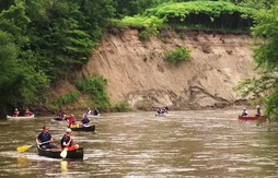
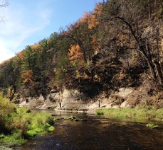
The
streams include the Whitewater River (photo at right) and tributaries, many of them popular for
trout fishing and other recreation. The river and streams all flow into the
Mississippi in the Winona area. This watershed covers 419,200 acres in Wabasha,
Winona and Olmsted counties. The majority of land is used for farming.
This
report is on a Total Maximum Daily Load (TMDL) study, which determines the
maximum amount of pollutants that a water body can accept and still meet
standards. This study will help local partners decide on ways to restore Lake
Winona and streams.
The
pollutants in this case include phosphorus that causes algae, bacteria that may
make water unsafe for swimming, sediment that makes water too cloudy for fish
and other aquatic life, and nitrate levels that may make water unsafe for
drinking.
This
area of Minnesota is vulnerable to pollution because of its karst landscape. In
karst, only a thin layer of soil covers the porous bedrock underneath and
allows pollutants on the land to easily reach groundwater used for drinking. In
a karst landscape, where caves and sinkholes are common, streams and
groundwater mix as water moves through the bedrock.
The
fish kill in the Whitewater River in July is not part of this study. While the
fish kill is still under investigation, it highlights the need to identify
pollution problems and take action to restore water quality.
For
more information on the study or to submit written comments, contact Shaina
Keseley, MPCA project manager, at shaina.keseley@state.mn.us
or 507-206-2622.
Related
story and report:
|
The U.S.
Environmental Protection Agency recently approved the Total Maximum Daily Load
(TMDL) report for the Mississippi
River-Lake Pepin Watershed.
This watershed
in southeast Minnesota is known for its coldwater streams and trout fishing. It
extends from Red Wing to Lake City and encompasses 205,747 acres (325 square
miles). This watershed is named for Lake Pepin because all the streams drain to
the lake. However, this study excludes Lake Pepin, which is the focus of a separate
project.
The TMDL report
focuses on reducing bacteria in Hay, Bullard, Gilbert, Miller and Wells creeks
in Goodhue and Wabasha counties. Strategies to reduce bacteria levels include
decreasing feedlot runoff, ensuring wastewater treatment, increasing rotational
grazing, managing manure applications to cropland, and increasing conservation
tillage.
|