Special thanks to Corey Sobel, Olena Borkovska, Chisimdi Onwuteaka, and Sophie Delaporte on the GRID3 team for their contributions to this article.
When it comes to geospatial data, accessibility is just as crucial as quality. While it is important to produce comprehensive spatial information that is useful to geographic information system (GIS) specialists whose work informs sustainable planning and decision-making, equal attention must be paid to ensuring that such data is easily accessible for the wider community, such as development practitioners, researchers, and governments. With this in mind, GRID3 has launched its Data Hub.
An online repository for GRID3 data, the hub can be used to inform development interventions ranging from COVID-19 vaccination campaigns to longer-term development projects such as filling service provision gaps. Currently, the hub hosts over 250 unique GRID3 datasets, including gridded population estimates for six countries; settlement extents (or the geographic areal coverage) for all of sub-Saharan Africa; and operational and administrative boundaries, risk analyses, points of interest, and physical distancing (also known as social distancing) data for multiple African countries.
“The Data Hub is a key step in helping partner countries disseminate GRID3 data across their government agencies, with international organizations, and among the wider geospatial community. With this platform, data can more easily reach those who need it the most.”
The hub hosts a range of visualization tools, including interactive web apps, dashboards, ArcGIS StoryMaps stories, media, and surveys. It is designed for easy discovery and exploration of GRID3 data without requiring GIS skills or specialized data visualization software. Data can also be easily integrated with other datasets available in ArcGIS Online and ArcGIS Living Atlas of the World to create interactive online maps.
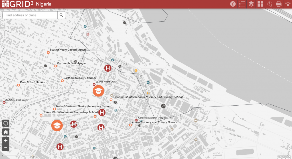
A snapshot of Lagos from the Nigeria web map highlights GRID3 data on infrastructure, or points of interest. 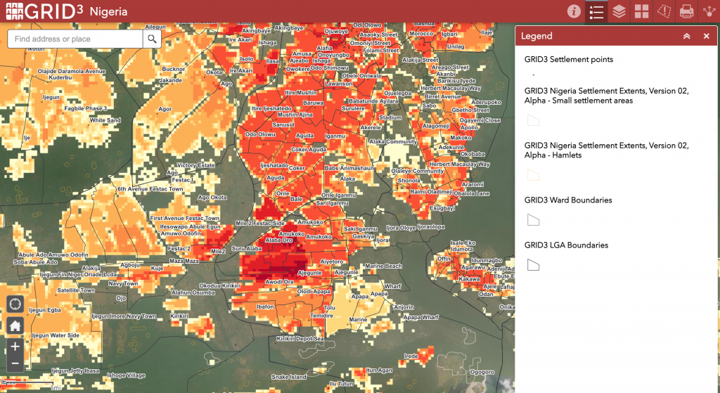
A snapshot of Lagos from the Nigeria web map visualizes GRID3 data on population and settlements. 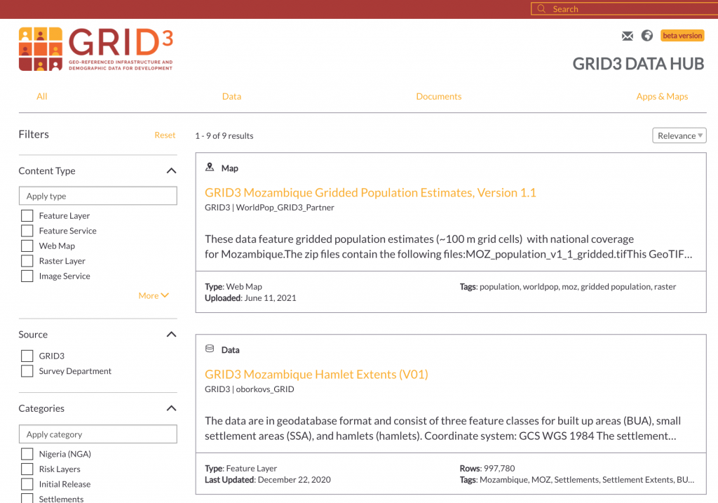
Datasets for Mozambique are shown in the above snapshot of the data catalog within the hub. 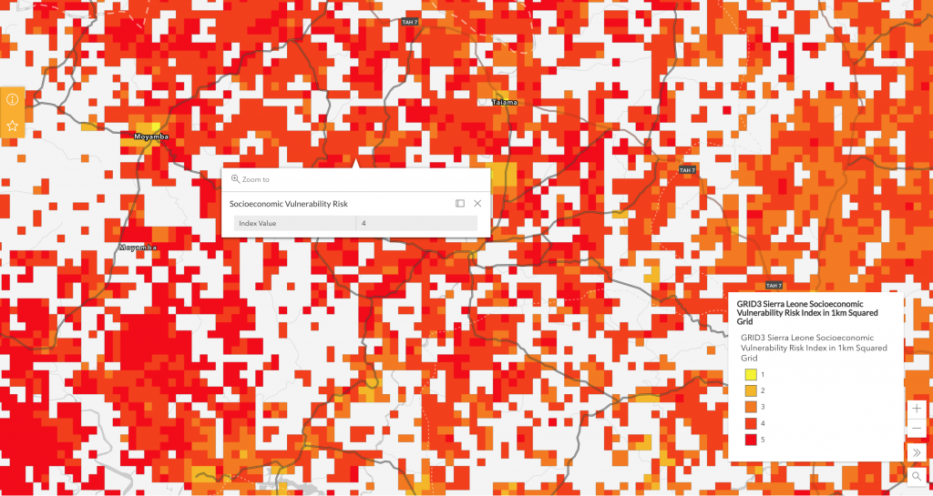
This snapshot of the Sierra Leone socioeconomic risk web map estimates the vulnerability of populations with limited options to cope with economic shocks through different risk levels. Risk-level values can be found by clicking on the map. Level 5 indicates areas with highest risk, while level 1 indicates areas with lowest risk.
Early last year, GRID3 and Esri produced country-specific hubs for Namibia, Nigeria, Sierra Leone, and Zambia that were used to support those countries’ COVID-19 response. Thanks to this collaboration, both were able to work closely and effectively on the development of the Data Hub, drawing on their respective fields of expertise.
With the launch of its Data Hub, GRID3 aims to bring together its data and country-specific data hubs into one platform. In the coming months, GRID3 and Esri will continue to collaborate on developing additional visualization tools (such as interactive dashboards and stories) that will further enhance the Data Hub interactivity.