B.C.: Heavy snow closes schools, Arctic blast prompts widespread warnings

British Columbia remains firmly locked in the grips of severe winter weather as more snow and a blast of frigid air prompts extreme cold and Arctic outflow warnings for most of the province. More on the record breaking cold this week, along with the threat for more low elevation snow, below.
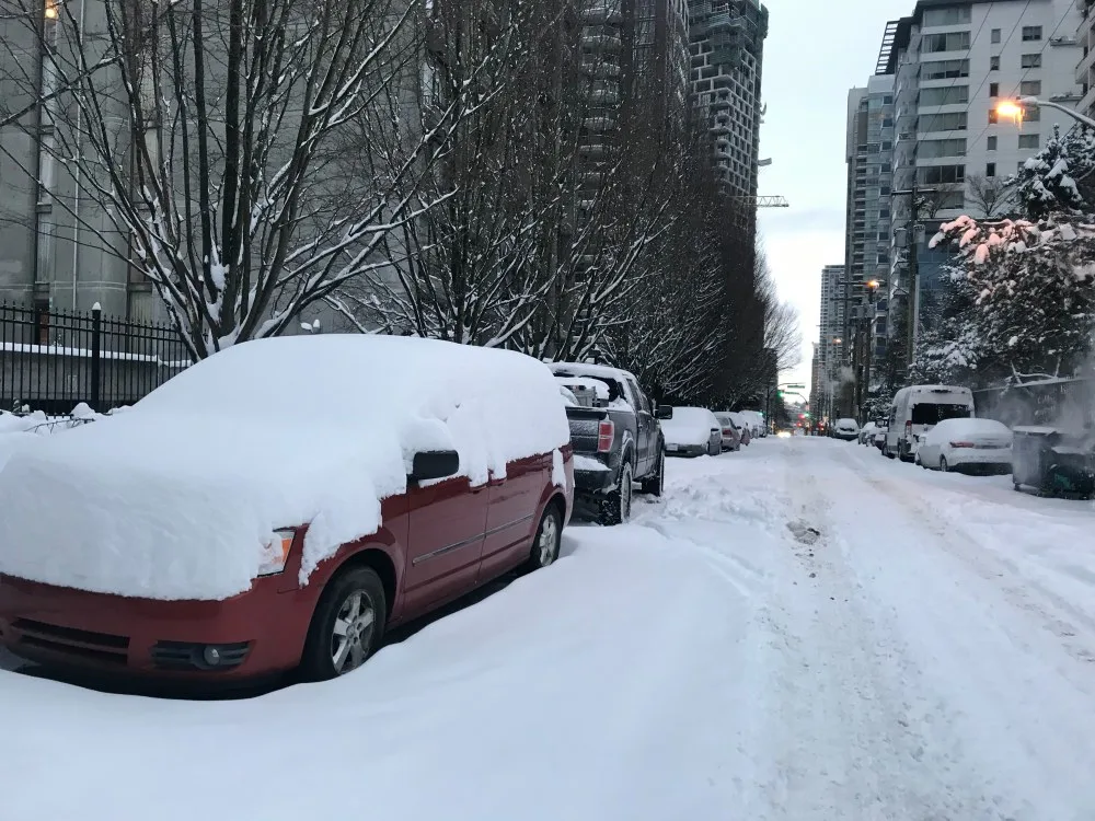
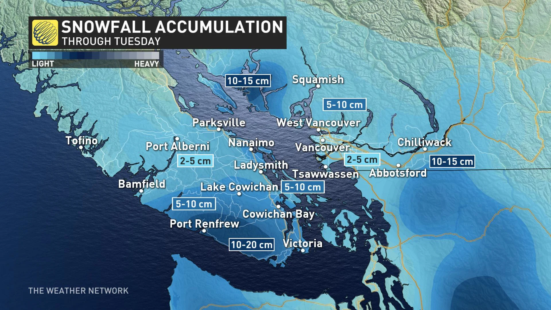
Strong Arctic outflow winds from the Fraser Valley collide with the southern Gulf Islands and southeastern Vancouver Island, producing heavy bands of snow at times and poor travel conditions. Amounts ranging from 5 to 15 cm piled up through the early part of Monday.
Several schools across the province closed for the day on Monday after the wicked weekend weather, that included heavy snow and winds, made for some unsafe slushy and slick conditions for parts of the region early Monday morning.
Around 6,500 people in the Lower Mainland, Okanagan and northern half of Vancouver Island also remained without power on Monday morning, following the weekend storm.
TUESDAY: EVEN COLDER, RECORD-SMASHING ARCTIC AIR
The Arctic front that pushed onto the South Coast Sunday night has prompted warnings for extreme cold and Arctic outflow across most of the province.
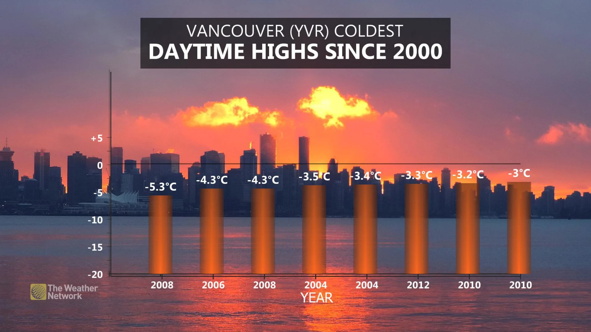
The early week forecast holds some teeth-chattering numbers, with the most frigid air of the century so far to come.
ARCTIC AIR MOVES THROUGH THE REGION
READ MORE: B.C. set for coldest temperatures this century
Afternoon highs on Monday will struggle to climb above the -10ºC mark for many, with highs near -5°C even closer to the water.
Gusty Arctic outflow winds will push temperatures even lower for Tuesday, making it feel closer to -10, even for downtown Vancouver and Richmond. The fresh layer of snow on the surface in many areas will also help to keep those temperatures chilly through the first half of the week.
THIS WEEK: SHOTS OF SNOW WITH SEVERAL MORE SYSTEMS LINED UP
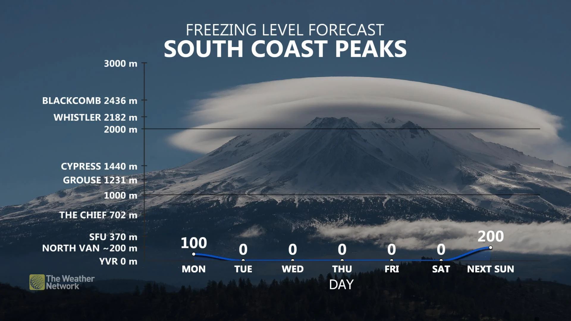
"The active pattern continues this week for B.C. with several more systems lined up and continuing through the weekend as well," says Weather Network meteorologist Dr. Doug Gillham. "Snow levels will be at sea level mid-week with more snow likely for Metro Vancouver and the Victoria area, especially with all that cold air in place."
Arctic air will gradually relax its grip on the region through late week and snow levels will rise above 1000 metres by the weekend.
"Heavy snow is still expected for the ski areas this weekend, but with rain for coastal areas," Gillham adds.
Stay with us here at The Weather Network for all your latest forecast updates.


