No Little Plans
Comprehensive plans can inspire their creators to tap their highest and best professional skills, training, and vision—or cause them to question their choice of profession. They often take a couple years to produce and can require extensive community outreach, sometimes with rancorous results—if, for example, the community has strong opposing opinions about a vision for future growth and development.
“Comp plans have the unfortunate reputation of being long, cumbersome documents that talk about vision and not the day-to-day situations that affect people,” says Peter Pollock, manager of Western Programs for the Lincoln Institute.
But Pollock says today’s comp plans are “addressing a much broader range of topics that relate more to people’s lives.” He says comp plans are being used to discuss issues beyond the traditional land use topics, as “vehicles for sustainability, community resilience, and other unifying concepts that have virtue.”
Indeed, sustainability and equity are objectives in recent comprehensive planning efforts in Seattle, Boston, and Denver—all hot-market cities dealing with an influx of knowledge-economy jobs and a dearth of affordable housing. These cities, members of the Big City Planning Directors Institute, sponsored by the Lincoln Institute of Land Policy, the American Planning Association, and the Harvard Graduate School of Design, have other long-range challenges in common, including the need for better multimodal transportation systems and stepped-up climate-change resilience. But their approaches to comprehensive planning vary widely, with one city updating policies every year, another updating after a half-century, and a third finding that integrating multiple detailed master plans may be more helpful than a comprehensive plan for long-range planning.
“Comp plans,” as they’re known in the vernacular, have been the linchpin of long-range land use planning and regulation since the City Beautiful Movement early in the last century. Local governments may adopt official comprehensive plan documents by ordinance to serve as policy guides for decisions about physical development in communities. They generally offer a vision and goals for future growth and development, and provide a framework for big-picture decisions, from preservation of natural resources to where to build new homes and locate jobs, improve transportation connections, and make capital investments such as utilities, sidewalks, and libraries. Comp plans analyze demographic information and discuss key community challenges and opportunities. Some focus exclusively on land use and development, while others include transportation, utilities, the environment, housing, education, parks and recreation, and other aspects of the life, form, and physical development of the community. Some plans enumerate city policies with lists of objectives and strategies. As “living documents,” some are updated every year; others every couple decades. Ideally, they’re coordinated with county and regional planning efforts. They often end with implementation ideas for future action.
“There are thousands of comp plans out there, with varying degrees of sophistication,” says David Rouse, research director for the American Planning Association and coauthor of APA’s 2015 Sustaining Places: Best Practices for Comprehensive Plans. The publication provides a framework and standards for creating livable, healthy communities in harmony with nature, with resilient economies, social equity, and strong regional ties. APA also established a recognition program for best practices in comp plans (see p. 27).
So what is new and different about comprehensive plans, and how are they being used? Land Lines asked long-range planners for Seattle, Boston, and Denver to share their experiences.
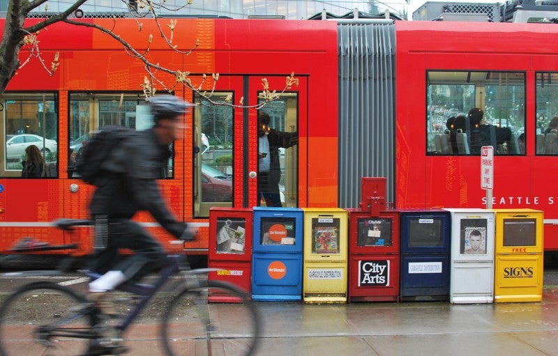
Seattle 2035 Comprehensive Plan
Seattle, one of 10 cities that took part in an APA pilot program to develop best practices for comp plans, has a “landmark sustainability comp plan,” says Rouse.
Adopted unanimously by the Seattle city council in October 2016, the Seattle 2035 Comprehensive Plan is the city’s third generation of comp plans, all focused on sustainability and all directing more urban growth into the city to preserve forests and farmlands beyond. Since it was first adopted in 1994, Seattle’s comp plan has guided growth over 20-year periods, with the city council annually adopting resolutions as policies to make sure the plan reflects current community conditions and values.
The Washington State Growth Management Act (GMA), passed in 1990, requires counties and larger cities to create comp plans, and to update them every eight years. The GMA’s goals include reducing sprawl and directing growth to areas that already have water, sewer, transportation, and other urban services. Each county must draw an urban-growth boundary beyond which urban-style development is not allowed. Comp plans must show that each city has enough land with the right zoning to absorb growth that is expected to occur over the next 20 years. Cities must also plan for housing, transportation, water, sewer, and other facilities that will be needed, and create plans that are consistent with other plans in the region.
To prepare for the new comp plan, the Seattle Office of Planning and Community Development issued a capacity analysis in 2014 entitled Seattle 2035: Updating Seattle’s Comprehensive Plan. It noted that Seattle’s population since 1994 had increased 20 percent, with nearly 100,000 new residents and much greater racial and ethnic diversity. Current growth projections for the city of 652,000 indicate 70,000 additional households and 115,000 additional jobs by 2035. The planning department also issued the Growth and Equity analysis to determine access to opportunity and risk of displacement throughout the city. The report indicates locations with the highest risks of displacement, as well as areas with the greatest access to education, transit, and employment. It features an equitable development framework for growth, a displacement index, and an analysis of alternative growth scenarios and their impacts on displacement.
Seattle’s 2005 comp plan called for the city to embrace growth. The 2016 challenge was different: how could the city leverage growth to build better neighborhoods, create jobs and economic opportunity for all residents, and improve the safety and vitality of the city?
While hundreds of residents participated in the 2005 process, the recent two-year update process, delayed a couple years because of the recession, involved residents in more than 24,000 website visits, 4,800 online open house visits, 2,600 appearances at workshops and meetings, 2,100 online survey responses, and thousands of facebook and Twitter comments. Topping the list of key issues Seattleites expressed was the need for housing that is affordable for middle and lower-income households. Seattle has been facing its worst housing crisis ever, due in part to tech-oriented businesses such as Amazon and Microsoft, which have introduced new residents in the tens of thousands. Mayor Ed Murray has set a goal of building or preserving 50,000 homes in 10 years, with 20,000 of them rent- and income-restricted. Among the new comp plan policies is an amendment allowing for alternative affordable home ownership opportunities that aren’t common in Seattle now, such as community land trusts, down payment assistance, mixed-income housing requirements, and limited-equity housing co-ops.
The new plan retains the concept that anticipated growth should be focused in the city’s densest areas—the designated urban centers of Downtown, First Hill/Capitol Hill, South Lake Union, Uptown, University District, and Northgate. To maximize public investment in infrastructure and services, the plan also continues to channel growth to 24 urban villages, or mixed-use areas with compact land use and density, such as light-rail station areas. Both urban centers and urban villages are places that already have active business districts, jobs, services, and concentrations of housing, and can accept more, says Tom Hauger, manager of comprehensive and regional planing.
Seattle’s previous comprehensive plan included neighborhood plans with specific visions of how and where development should occur, and made a binding commitment to those visions. To match more recent language in the city’s zoning code, the new plan removed a requirement that upzones—or changes in zoning to allow for more intensive use—must be approved in neighborhood plans before the whole comp plan is adopted. This change allows “a little more wiggle room” to add some multifamily housing to single-family neighborhoods, which comprise about half the city’s 84 square miles, says Hauger. This change now allows for upzoning to occur, even outside the urban villages—if, for example, an area is within the 10-minute “walk shed” of a light-rail station or very good bus service. But Hauger says the city wants to study the issue at greater length and work with the Mayor’s Housing Affordability and Livability Agenda (HALA) advisory committee on neighborhood boundaries. Hauger says the upzoning debate features “strong arguments on both sides, though the urban villages have enough capacity for 40 to 50 years of growth. So the need to upzone single-family neighborhoods is not necessary today.”
Perhaps the biggest change in the new plan relates to equity. All three of the city’s comprehensive plans have expressed the core values of environmental stewardship, community, economic opportunity and security, and equity—though these core values have been reordered with each iteration as community values dictated. A 2015 resolution adopted by city council changed “social equity” to “race and social equity,” and this value rose to the top of the list in the recently adopted plan, to emphasize the need to address disparities experienced by people of color, says Hauger.
“We’ve identified ways in which the city, through growth, could help communities that have been underserved in the past, and could reduce the risk of displacement for those populations,” says Hauger. The new comp plan includes over 120 new policies that relate to social and racial equity. It specifies growth will be reduced in high displacement areas and directed to areas with more transit, education, and employment opportunities. The plan also calls for monitoring growth in locations where low-income households and people of color are at risk of displacement. “The shift to equity, especially with rapid growth, is really the focus of the plan,” he says, “but that’s also a part of sustainability.”
Imagine Boston 2030
Boston is a good example of a city where the previous comp plan—called a general plan here—was about land use and development. “But it’s a new day in Boston,” says Pollock, and the new comp plan process has been “about the community, quality of life, and checking on residents’ needs and values.”
In the two generations since Boston issued its last citywide plan in 1965, the city has changed dramatically. The loss of industrial jobs in the 1960s, racial tensions, and other factors led to the loss of about one-third of Boston’s population, which hit a low point in 1980 with 563,000 residents. Since then, the city has rebounded by building a new knowledge-based economy, supported by a legacy of world-class hospitals and universities.
In 2015, anticipating Boston’s 400th birthday in 2030, Mayor Martin J. Walsh launched a new comprehensive plan process (the city is not required to create a comp plan, and city council does not have to adopt or approve a plan). The mayor had two major goals for the plan, says Sara Myerson, director of planning for the Boston Planning and Development Agency (formerly the Boston Redevelopment Authority). The first goal was, she says, “to be a true reflection of Bostonians’ view of the city in the future, because knowing residents’ views about prosperity and shared values would be important when making difficult decisions, and would change the way we govern. The second goal was to move across silos and create a different way to coordinate planning policy.”
Imagine Boston 2030: Expanding Opportunity addresses growth, economic opportunity, and resilience—“with equity at the heart of the plan, and a focus on making Boston more innovative while making the city more inclusive,” says Myerson. A draft of the plan is under review, and a final plan is due out this summer. Imagine Boston is the result of four years of planning and two years of community outreach to create a comprehensive policy framework for the city, says Myerson.
Imagine Boston is addressing a broad range of issues—housing, health, education, the economy, energy and the environment, open space, transportation, technology, and arts and culture. Recent changes have prompted the new long-term vision: between 2010 and 2014, Boston grew 6 percent, twice the national rate, adding almost as many residents in four years as in the previous 20. The city’s 2016 population of 667,000 is projected to reach 724,000 by 2030, with 15 percent more jobs and a need for 20 million additional square feet of new office, retail, and industrial work spaces. Boston has also become more diverse, with more than a quarter of all Bostonians born outside of the United States. A wide wealth gap exists between white residents and residents of color, who are now in the majority. Neighborhoods have disparities in educational attainment, home ownership, commute times, and access to healthy food and health care that correspond with levels of wealth and poverty. Housing affordability is a critical need, as 46 percent of Boston households are cost-burdened, spending over a third of their income on housing. To accommodate projected growth, Mayor Walsh in 2014 called for 53,000 new homes across income levels by 2030 (10,000 have been built and another 7,000 are under construction).
Another key issue is resilience: as one of the nation’s top four cities at greatest risk of flooding, Boston faces increasing temperatures, extreme coastal storms, and climate-change-related sea level rise, which pose significant risks for Boston’s highly urbanized neighborhoods and coastal job centers. Boston’s sea level rose about 9 inches during the 20th century. Between 2000 and 2030, it’s projected to rise at a rate almost three times greater. An estimated $55 billion in assets are exposed to a 100-year flood event. Planners are coordinating the comp plan work with the Mayor’s Office of Resilience and Racial Equity, supported by the Rockefeller Foundation’s 100 Resilient Cities program, to help Boston plan for and deal with climate-related disasters and other challenges. Boston is planning for climate adaptations with its Climate Ready Zoning, building level adaptations, and district-scale planning.
Imagine Boston planners began extensive community outreach by asking Bostonians to identify their biggest priorities and concerns. Residents responded: housing that is affordable, education that expands opportunity, and reliable and efficient transportation. The community outreach process has yielded responses from 14,000 residents, through traditional open houses, panel discussions, visioning kits, community workshops, online maps, and text-messaging surveys. Some 9,000 responses came from surveys administered by street teams.
“The street teams represented the diversity of Boston,” says Rebekah Emanuel, executive director of Imagine Boston, with some teams engaging residents more playfully, using building-block exercises at farmers markets, parks, and other gathering places. They discussed trade-offs and “how people thought growth should be guided in their neighborhoods” and other potential development areas, she adds. Community outreach helped identify five goals for the plan: 1) encourage affordability, reduce displacement, and improve quality of life; 2) increase access to opportunity; 3) drive inclusive economic growth; 4) promote a healthy environment and prepare for climate change; and 5) invest in open space, arts and culture, transportation, and infrastructure. The comp plan also directed five main actions: enhance neighborhoods, expand neighborhoods, develop mixed-use job centers, develop a waterfront city for future generations, and create networks of opportunity.
The city of 49 square miles of land is looking to support residents’ vision of a more connected mixed-use and mixed-income community by fitting more people and jobs into neighborhoods. The comp plan locates “action areas” with capacity to accommodate Boston’s projected growth in existing neighborhoods and commercial cores, and to reduce housing-price pressure, improve access to opportunity, and stitch together the physical fabric of the city. “Expanded” neighborhoods will vary in size and scale, from development of “neighborhood edges”—or sites on the waterfront, on fringes of stable neighborhoods, or near rail lines—to larger-scale areas with still-vibrant industrial uses that will see significant new mixed-use housing, job sites, and services. These larger, more transformative areas will pilot innovation centers and planning and infrastructure investments to support new office, lab, and industrial spaces. They also will benefit from zoning for climate-change resilience, sustainable building standards, and flood protections, as well as open spaces and places for arts and culture.
Planners reviewed comp plans from a number of other cities, and they found Seattle’s equity and displacement elements particularly applicable to Boston, which is developing a displacement tool kit. “The mayors of Boston and Seattle have had many conversations about growth and displacement,” says Myerson. “That really resonates with us.”
In Boston’s new comp plan, “there’s a real desire to tackle complex urban challenges with policy solutions that cut across silos,” says Myerson. “We’re really creating a hybrid of planning and other disciplines, as a reaction to the complex challenges cities are facing. Many cities are thriving right now, so it’s not about attracting investments, but figuring out solutions to challenges of growth while continuing to build on investments in an innovative economy.”
Denveright/Blueprint Denver
Denver is also taking a different approach to traditional comprehensive planning with a new integrated planning process, called Denveright, involving updates in four key areas that will guide local planning for the next 20 years. The city is now halfway through the 18-month Denveright process, in which four master plans—the Blueprint Denver integrated land use and transportation plan, the parks and recreation plan, the pedestrians and trails plan, and the transit plan—are being updated collaboratively. Denveright is an umbrella project for all the plans, bringing the processes together to maximize resources, make the planning process more efficient, and ensure the plans work together holistically to accommodate future growth. Blueprint Denver and the parks and recreation plan will be adopted by the Denver city council, but the pedestrians and trails and the transit plans, both overseen by public works, will not.
“The benefit of doing all these plans at once is cross-collaboration and an interdisciplinary approach,” says Kimball Crangle, cochair of the Blueprint Denver Task Force. City staff and the cochairs for each plan’s task force are working together to produce a body of policies that will provide a cohesive vision for where and how growth happens. “We see tremendous opportunity in having the plans speaking in the same language,” says Crangle. “They will be dated when we sign them, but at least we’ll be on the same page in terms of how we implement goals across our city.”
“The Denveright process is a significant improvement over the previous approach, doing separate plan updates sequentially,” says Brad Buchanan, executive director of Denver Community Planning and Development. The Denveright discussions “happen in real time,” he says. “The same questions come up week by week with the forces, and they make sure the priorities of all their plans are shared. It’s a more robust process than we’ve ever done before, with a stockpile of deep and rich research in each area.”
As in Seattle and Boston, a vision of sustainability has guided Denver’s comprehensive planning, and it’s evolving through community outreach efforts to include new focuses on social equity and resilience. In 2016, as part of the Denveright process, the Lincoln Institute and the Sonoran Institute, in a Western Lands and Communities joint venture, led exploratory scenario planning workshops on future growth and development for the Blueprint Denver update. The Denveright project is continuing to explore scenario planning with Calthorpe Associates and has created a board game that residents can play at public meetings or online, to weigh in on their choices for where density, transit, and other elements should go in the 155-square-mile city. Denver grew from 468,000 residents in 1990 to 683,000 in 2015, and it’s projected to add another 200,000 residents within 20 years. Citing a housing crisis as the city’s top priority, Mayor Michael Hancock has proposed spending $150 million over the next 10 years to build more affordable housing.
When Denver city council adopted the 2000 comp plan, the city was a very different place than it is today. The Central Platte Valley’s former rail yard had been cleared of its tracks, but redevelopment had not begun on the Denver Union Station neighborhood, which has attracted $2 billion in infrastructure and mixed-use development, with the historic train station restored as a multimodal transit hub for the metro region. Many of the city’s transit lines and station areas that would be built as part of the 2006 FasTracks regional light-rail and bus network did not exist. Large master-planned communities within the city, including Stapleton and Lowry, were in the early construction or planning stages.
The Blueprint Denver plan was adopted in 2002 to help implement the 2000 comp plan and to ensure that continuing growth and development would be located in the most sustainable places. Blueprint Denver’s goals were to direct development to “areas of change,” to limit change in “areas of stability,” develop multimodal streets, and promote mixed-use development and urban centers. Preserving residential neighborhoods was a big focus of the plan at a time of significant “scrape-offs” and “pop-tops” of existing homes.
Areas of stability, encompassing 82 percent of the city, included residential neighborhoods and were marked for character preservation or new investments. Growth was channeled to much denser areas of change, including downtown, commercial corridors, and areas around transit stations, as well as the city’s large redevelopment sites.
Blueprint Denver’s role in locating growth, along with a citywide zoning code overhaul in 2010 that introduced form-based and context zoning and allowed over 6,100 acres to be rezoned from single-use to mixed-use zone districts, many of them near existing or planned transit stations, have helped achieve a more sustainable urban form. Since 2002, two-thirds of new housing (67 percent) and jobs (64 percent) occurred in areas of change, according to Blueprint Diagnostics, a 2016 analysis report prepared for the Blueprint Denver update.
Blueprint Denver is now evolving with more focus on equity issues and resilience in the broadest sense, says Crangle. She says the task force is considering how the city could provide benefits, such as stable affordable housing, parks, trails, transit connections, convenient services, and other healthy infrastructure and amenities, to lower-income neighborhoods undergoing redevelopment and displacement pressures. “In Denver, we have opportunity to spread equity—social, financial, health, general wellbeing. What kinds of benefits do [these neighborhoods] get, and how do we ensure that the people and businesses that have been there for decades can stay?”
American Planning Association (APA) Best Practices for Comprehensive Plans
In 2015, APA published Sustaining Places: Best Practices for Comprehensive Plans (https://www.planning.org/publications/report/9026901/) to define the role of comprehensive plans in developing sustainable communities, and to demonstrate how to turn principles into plans and score the results. APA established a set of standards and a recognition program for best practices in which communities submit their completed comp plans, and APA reviewers score them bronze, silver, or gold. Now in the second year of the recognition program, APA will announce its first gold standard comp plan at its annual conference in New York in May 2017. “Even if cities don’t want to be scored, they can use this document to assess their own comp plans,” says David Rouse, APA research director.
“We’re attempting to be bold and allow a broad-based land-use guiding document that allows for change and evolution,” says Crangle. “Twenty years is a long time, a couple of business cycles, and this document can’t be prescriptive. Our job is to provide the foundation for land use to evolve as the city changes and to allow flexibility.”
The comp plan itself is not being updated, and it’s not clear whether it will be, says Buchanan. “Our comp plan is very high-altitude and more aspirational.” Blueprint Denver and other specific plans are the primary policy documents for the decision-making process, he says. “When our comp plan was adopted in 2000, these other plans didn’t exist, and since these other finer-grained plans have emerged, there is less reliance on it.” Buchanan says no decision has been made yet, but the question has been asked: “does Denveright become the keeper of this family of plan documents going forward, and does it replace the comp plan?”
Value-add for Communities
What is the value of a comp plan in the end? “Planners’ strength is that we know a little about a lot, and we can be great integrators and bring together different elements at play in a city,” says Pollock. “You don’t do that by regulations about heights of buildings, but by bringing people together to achieve goals.”
Although the community process may appear to seek general agreement, comp plans aren’t designed to “reach consensus,” he says. “It’s a huge challenge: how are you using the comp plan to engage the community, and how do you deal with the reality of different goals and visions?” The document will be adopted by the community’s representatives, he says, and while everyone does not get a vote, the comp plan ideally values the whole community’s goals, hopes, and dreams and provides guidance on how to achieve them.
“Those of us who are more aspirational see the comp plan as a way to bring in broad elements but also to incorporate a vision for community,” Pollock says.
Kathleen McCormick, principal of Fountainhead Communications in Boulder, Colorado, writes frequently about healthy, sustainable, and resilient communities.
Photograph: plainurban/Flickr