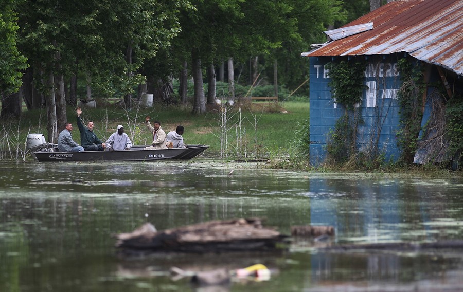
Very slowly, the high waters of the swollen Mississippi River are making their way south to Louisiana. Weeks of heavy rains and runoff from an unusually snowy winter have flooded thousands of homes and over 3 million acres of farmland in Mississippi, Tennessee, and Arkansas. The river is expected to crest at a record height of 58.5 feet sometime today in Vicksburg, Mississippi, 200 miles north of New Orleans. In order to spare larger cities and industrial areas downstream, the U.S, Army Corps of Engineers has opened floodgates in the Morganza Spillway, north of Baton Rouge, Louisiana, allowing an estimated 100,000 cubic feet of river water to flow into the Atchafalaya Basin every second. Collected here are images of the Mississippi and those caught in its path over the past few days -- coping, watching and waiting. [ See also: What We've Done to the Mississippi River: An Explainer by Alexis Madrigal. ]
Mississippi Floodwaters Roll South
-
![]() Read more
Read moreA levee protects a home surrounded by floodwater from the Yazoo River on May 18, 2011 near Vicksburg, Mississippi. The flooded Mississippi River is forcing the Yazoo River to top its banks where the two meet near Vicksburg causing towns and farms upstream on the Yazoo to flood. #
Scott Olson/Getty Images -
-
![]() Read more
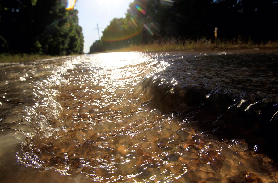
Read moreWater rushes over dirt roads inside the Morganza Floodway as water from the flowing floodway heads south near Krotz Springs, Louisiana, on May 17, 2011. #
Reuters/Sean Gardner -
![]() Read more
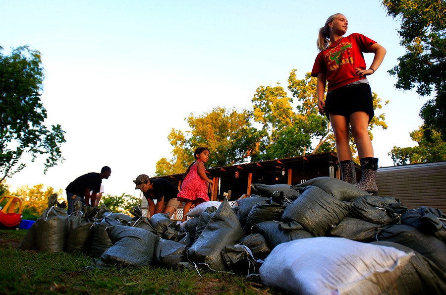
Read moreBrittany Pearce (right) stands atop a mound of sandbags in front of her grandparents' house in Stephensville, Louisiana, on May 15, 2011. #
Reuters/Sean Gardner -
![]() Read more
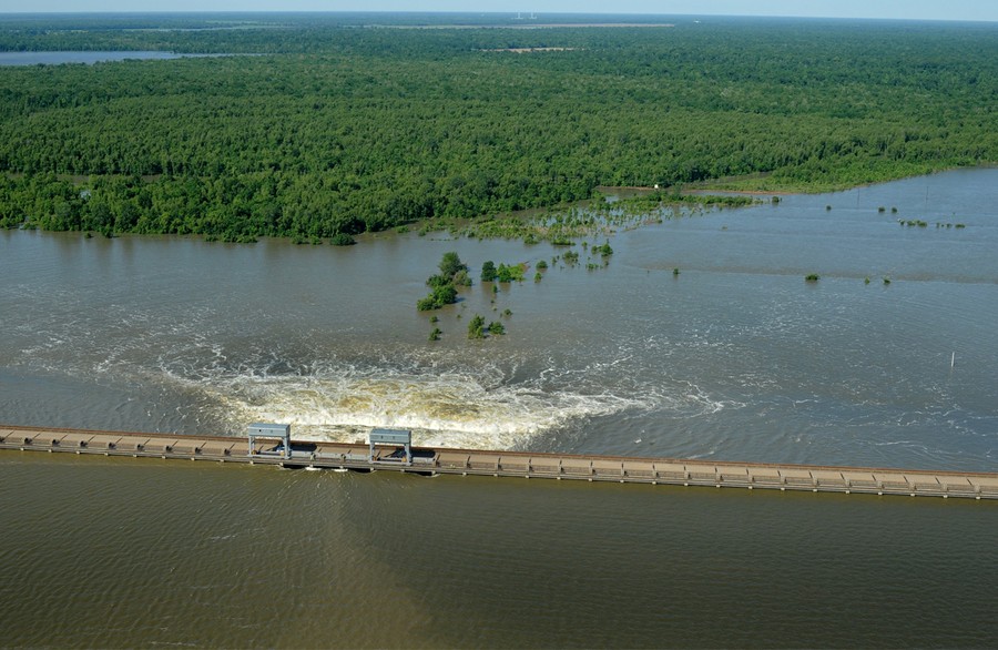
Read moreWater flows through four open gates of the Morganza spillway into the Atchafalaya River basin, on Sunday, May 15, 2011. The spillway's opening diverted water from heavily populated New Orleans and Baton Rouge - along with chemical plants and oil refineries along the Mississippi's lower reaches - easing pressure on the levees there in the hope of avoiding potentially catastrophic floods. #
AP Photo/The Lafayette Daily Advertiser, P.C. Piazza -
-
![]() Read more
Read moreFloodwaters from the Mississippi River have closed Highway 61 north of Natchez, Mississippi, on Tuesday, May 17, 2011. #
AP Photo/Dave Martin -
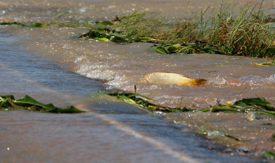
![]() Read more
Read moreA carp tries to swim from the backwater that has flooded the corn fields across River Road north of Yazoo City, Mississippi, on Thursday, May 12, 2011. Fish displaced by the flooding of the Mississippi River and forced into the backwaters of the tributaries are trying to return the their natural environment. #
AP Photo/Rogelio V. Solis -
![]() Read more
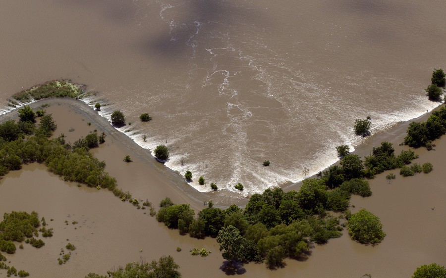
Read moreSubmerged buildings are seen near Lake Providence, Louisiana, on May 18, 2011. #
Reuters/Eric Thayer -
-
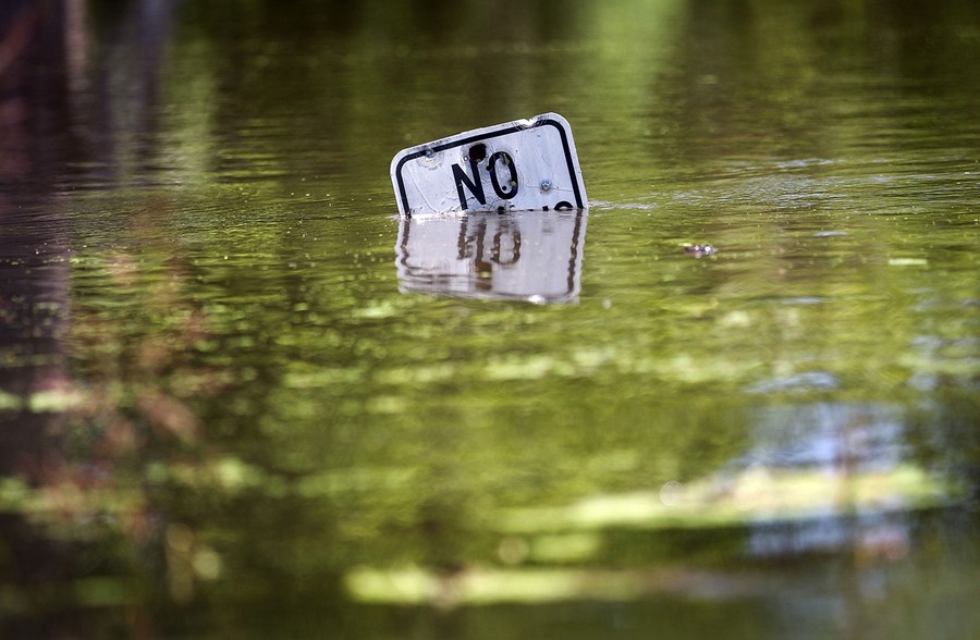
![]() Read more
Read moreA street sign is barely visible in the rising water of the Atchafalaya River, on May 16, 2011 in Simmesport, Louisiana. #
Mario Tama/Getty Images -
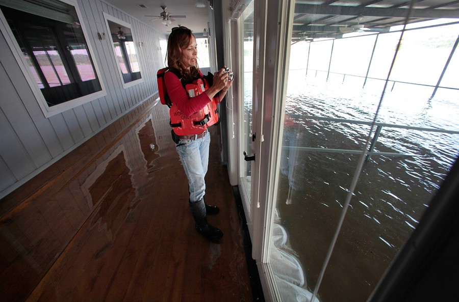
![]() Read more
Read moreCarla Jenkins, owner of Vidalia Dock and Storage in Vidalia, Louisiana, takes photos of the rising floodwaters of the Mississippi River, from inside her flooded office in Vidalia, Louisiana, on Wednesday, May 18, 2011. #
AP Photo/Gerald Herbert -
![]() Read more
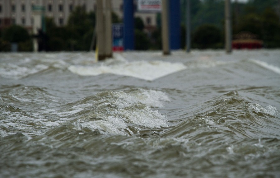
Read moreWaves form as the flooding Mississippi River spreads into Tunica, Mississippi, on Sunday, May 15. 2011. #
Lance Cheung/USDA -
-
![]() Read more
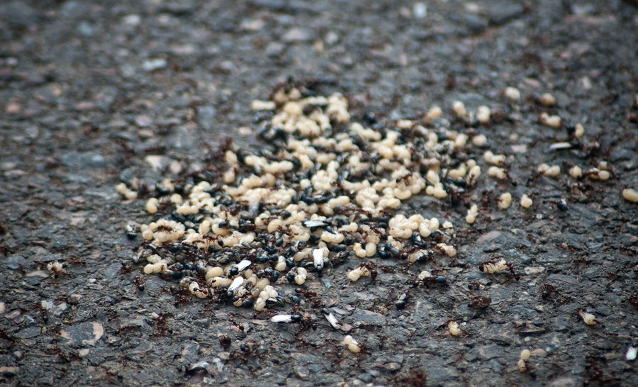
Read moreFire ants relocate their eggs onto the roadway. escaping the floodwaters of the rising Mississippi River near Yazoo City, Mississippi, on Monday, May 16. 2011. #
Lance Cheung/USDA -
![]() Read more
Read moreFloodwaters from the Mississippi River creep inland across the shore in Natchez, Mississippi, on May 17, 2011. #
AP Photo/Dave Martin -
![]() Read more
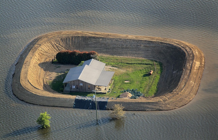
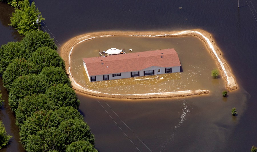
Read moreA flooded home surrounded by a makeshift levee that failed in Vicksburg, Mississippi, is pictured Tuesday, May 17, 2011. #
AP Photo/Dave Martin -
-
![]() Read more
Read moreThe Mississippi River flows through open gates of the Bonnet Carre spillway in Norco, Louisiana, on Wednesday, May 18, 2011. The river water is being diverted into Lake Pontchartrain to help ease the pressure on the levees downstream near New Orleans. #
AP Photo/Bill Haber -
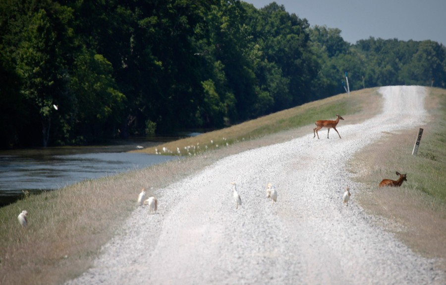
![]() Read more
Read moreA deer makes its way from the flooding Atchafalaya Basin in Lottie, Louisiana, on May 18, 2011. Floodwater released from a key Mississippi River spillway surged through Cajun Louisiana, but levees protecting the state's two biggest cities held as river flows neared their peak. #
Reuters/Lee Celano -
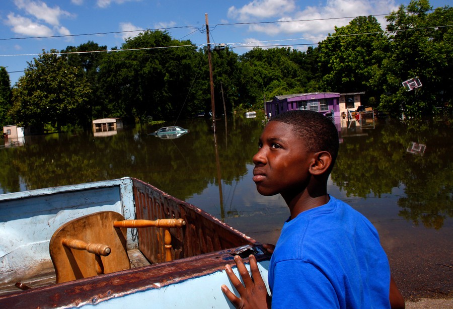
![]() Read more
Read moreJesse Wilson stands by his grandfather's truck near floodwaters in Vicksburg, Mississippi,on May 17, 2011. #
Reuters/Eric Thayer -
-
![]() Read more
Read moreAn overflowing levee is seen near Lake Providence, Louisiana, on May 18, 2011. #
Reuters/Eric Thayer -
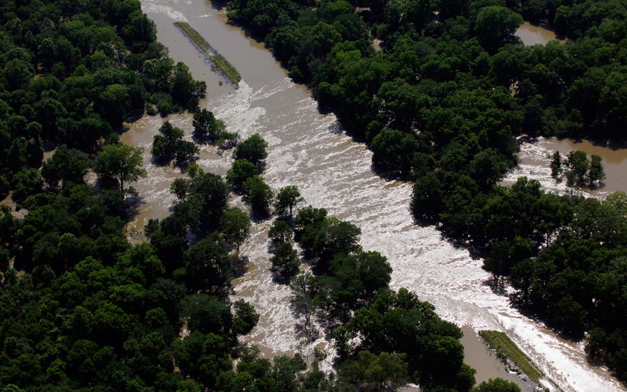
![]() Read more
Read moreResidents boat through a flooded section of the Atchafalaya River, on May 14, 2011 in Simmesport, Louisiana. #
Mario Tama/Getty Images


We want to hear what you think about this article. Submit a letter to the editor or write to letters@theatlantic.com.