© JTiernan

© JTiernan

© JTiernan

© JTiernan

© JTiernan


Some of the best powder of the season
And we still have 10 more days!
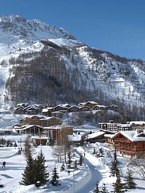
The past week in the Espace Killy has been absolutely epic, so sorry if you haven’t been here during the last weeks of the season as you’ve missed some pretty special conditions for the final week of April.
The Espace Killy have received up to 30cm in some areas (such as the top of the Grande Motte) and 10cm in lower areas and down to the resort, with the temperatures plummeting to the minus figures, this has kept the snow in perfect condition across the whole resort.
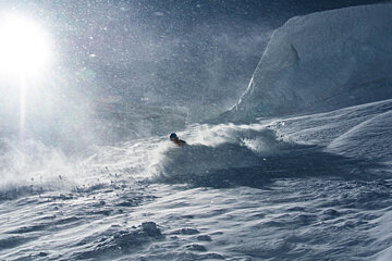
The best of that snow could be found up on the Grande Motte glacier where temperatures had peaked far below minus 10 to give some dry powder on all of the off-piste locations and some well groomed snow on the pistes. Because of high winds & poor visibility during periods of snowfall, the cable car remained closed until Thursday 28th.
However, when it did finally reopen again on Thursday, there was some of the best powder I’ve had all season to be found on the North Face of the Grande Motte - if you’re looking at heading up to the north face, check out our guides page to get a list of recommended guides to show you the best spots.
There is still currently 100% lift service in the Espace Killy, but expect many of the lifts begin to shut down as we start to near the end of the season. Until May 1st the Tignes - Val d'Isère link remains open, but after the 1st May, Val d’Isére shuts for the season, you can also ski from 3,456 m (top of the Grande Motte cable car) to 1,550 m (Tignes les Brévières) until this time. From May 2nd to 8th: Grande Motte area (except the Lanches chairlift) and Tovière area -Tovière gondola, Tufs and Bollin chairlift and Tignes le Lac carpet are all open for use.
Snow depths: 59cm @ 2100m & 145cm @ 3000m - expect this to rise following the weekend’s snow showers.
There looks to be even more snow coming in over Saturday / Sunday with the temperatures remain cold until the end of the week. At the start of the week, expect the temperatures to rise and snowpack thawing to continue, it’s been a great spring!
Today 29/04/2016 1° Partly cloudy. Light air, 1 m/s from west- southwest. 0 mm precipitation.
Saturday 30/04/2016 2° Heavy snow showers. Light air, 1 m/s from south- southwest. 9 mm precipitation.
Sunday 01/05/2016 -1° Cloudy. Light air, 2 m/s from north- northwest. 0 mm precipitation.
Monday 02/05/2016 1° Partly cloudy. Light air, 1 m/s from west. 0 mm precipitation.