As I’m sure you’ve heard, Japan was hit this morning by a massive earthquake and subsequent tsunami. There are already a variety of Earth/Maps-related resources to provide information about the quake, and we’ll summarize them here.
The first is Google’s People Finder, a tool that they provide in these types of situations. You can also visit their Crisis Response page for much more information.
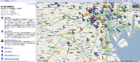
Next is also a Google Map showing the location of temporary shelters that have been set up in Japan.
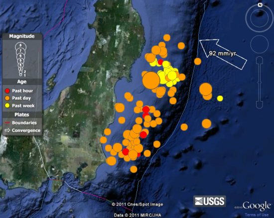
Next is this Google Gadget , which uses the Google Earth plug-in to show real-time earthquake information world-wide.
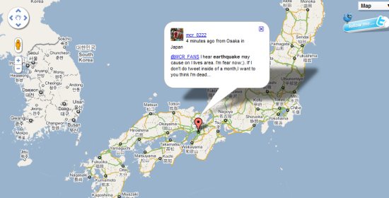
Next is a map showing earthquake-related Tweets from Japan.
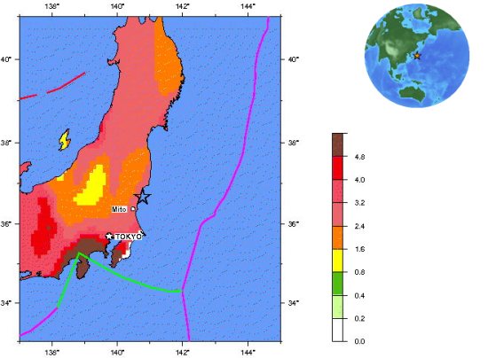
Lastly we have a collection of maps from the US Geological Survey that gives a lot more information about the quake and tsunamis.
If you have more sources of useful geo-related data about the quake, please leave a comment and let us know.