Heading out the door? Read this article on the new Outside+ app available now on iOS devices for members! Download the app.

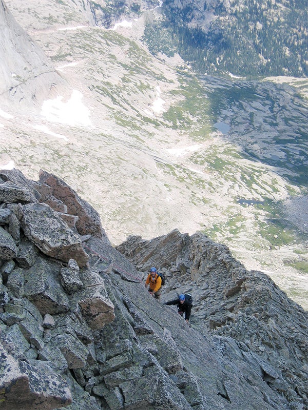
Sometimes, when committing to a move, I hear my friend Lee’s cranky voice in my head: “Could you pull that 600 feet off the deck?” It’s his old-school way of busting my chops. Sure, Brendan, you can climb 5.whatever in the gym, or at the crag, but are you confident enough to do the same thing high on a face 10 miles from the car? Can you keep your composure onsighting a route on a peak, not totally sure if you’re on the right route, with rock that looks OK, but might have loosened during its previous freeze-thaw cycle? Pulling a crux move in the alpine is just that much more exciting. It’s an addictive feeling that every climber should experience. So we’ve curated a list of seven introductory alpine routes that keep the adventure high and the technical difficulty at a mellow 5.8 or lower.
The Armadillo (5.7, 6 pitches)
Katahdin, Maine
Enjoy a big day on the Northeast’s longest summit rock climb
Katahdin is legendary to Henry David Thoreau devotees, Appalachian Trail thru-hikers, and the scramblers who summit via its famously exposed (but only class two) Knife Edge—but it’s also got several underrated rock climbs. The Armadillo is the Big K’s most classic: Varied climbing on steep, quality granite with airy moves and views 2,000 feet down into the pine-carpeted bowl of Katahdin’s South Basin. Bluebird days (target July to September) deliver shimmering reflections from the icy, blue waters of Chimney Pond below. A climb this long reaching a true summit is rare east of the Mississippi.
BETA
Get there: The crux of The Armadillo might be the logistics. Get to the Roaring Brook parking lot (eight miles north of the Togue Gate at Baxter State Park on Roaring Brook Road) in time to get a parking spot—the lot fills up fast on busy weekends, so be there by 5 or 6 a.m. Then make sure you make it up the three-mile, 1,500-foot elevation-gain hike to Chimney Pond by 8 a.m., which is the cut-off time for climbers attempting routes on Katahdin. You don’t need a permit, but you do have to check in with the rangers and have a quick gear inspection. Some wannabe summiteers have allegedly been turned around for not having a No. 4 cam, so make sure your rack is complete. From Chimney Pond, hike up slabs to the right side of a huge triangular flake lying against the base of the buttress on a grassy ledge. Rope up here and start climbing the chimney. From the top of the flake, head up and left on exposed, steep face climbing past old pins to the base of a 60-foot 5.7 fist crack; this is where you want your No. 4. At the top of the crack, the route heads right, and the climbing eases up to get to the Knife Edge that takes you all the way to the craggy summit.
Descent: From the summit, hike back down the Knife Edge and descend the Helen Taylor Trail to the parking lot.
Stay there: Camp at the Roaring Brook Campground or backpack 3.3 miles to the Chimney Pond Campground ($11 to $30 per night, reservations recommended, baxterstateparkauthority.com, 207-723-5140).
Guidebook:Rock Climbing New England, by Stewart Green ($35, falcon.com)
North Buttress (5.7, 6 pitches)
Pagoda Mountain, Rocky Mountain National Park, Colorado
Tackle a park classic without queueing up at the base
When alpine season begins in the park, climbers flock to the classics: the Petit Grepon, the Casual Route on the Diamond, and the North Ridge of Spearhead. But while everyone else is bee-lining for these routes, change course and head to the North Buttress of Pagoda, a quality six-pitch route that gets one-fifth the traffic. It also delivers alpine views of the half-dozen 13ers (and one 14er—Hello, Longs!) that wrap around the Glacier Gorge cirque; you can see them all the way up to the 13,497-foot summit. Splitter cracks, juggy climbing on the steep crux fourth pitch, and a section of chimneying make the case for this route to be included among the best of RMNP alpine rock climbs. Local guide Eli Helmuth says it’s arguably an “even more aesthetic and inspiring route” than the next-door North Ridge of Spearhead.

BETA
Get there: Get a bivy permit at the RMNP backcountry office; reserve starting March 1 ($20, 970-586-1319). From the Glacier Gorge trailhead, hike six miles to find a bivy spot under overhanging boulders near the base of Spearhead. (Doing it in a day is possible, but a long day.) Get an early start and scramble up the left side of the buttress. Near the bottom of the obvious black band of rock that crosses the face, a system of left-facing corners bisects the buttress. Traverse to the bottom of the corner system and rope up there.
Descent: Walk off the east ridge of Pagoda toward the saddle between Pagoda and the Keyboard of the Winds. Scramble northwest down talus back to your bivy.
Stay there: Camp at the Moraine Park Campground ($20 per night) in RMNP; reservations recommended (recreation.gov, 877-444-6777).
Guidebook: Rocky Mountain National Park, The Climber’s Guide: The High Peaks, by Bernard Gillett ($31, earthboundsports.com)
East Ridge (5.6, 3-4 pitches)
Disappointment Peak, Teton Range, Wyoming
Tag a summit on this intro to Teton climbing course
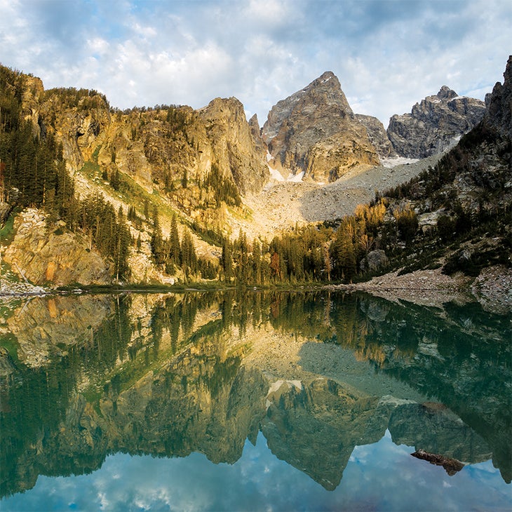
It may seem like there is only one mountain in Grand Teton National Park—the Grand Teton—with only two climbing routes on it: Exum Ridge and the Owen-Spalding. Or that’s what you might think if you hiked up Garnet Canyon on a summer weekend. But there’s so much more, including the East Ridge on Disappointment Peak. Jack Durrance (legendary claims to fame include the North Face Standard—the first route on the Grand’s, yes, North Face—and the Durrance Route on Devils Tower) first climbed this ridge in 1937. You’ll likely have the route to yourself, and it’s a great introduction to alpine climbing, with mostly easy climbing until the last pitch. All done in a world-class mountain setting. The final steep moves past a couple fixed pins are full-value Teton rock climbing, with 1,000 feet of air around the corner into Glacier Gulch to your right.

BETA
Get there: From the Lupine Meadows trailhead, hike up the Garnet Canyon Trail to Amphitheater Lake, where the East Ridge will be plainly visible on the lake’s north side.
Descent: Walk down the southeast ridge of Disappointment Peak to Amphitheater Lake—a little route-finding will keep the scramble easy at third class.
Stay there: Crash at the AAC’s Teton Climbers’ Ranch inside the park ($16 for members/$25 non-members), reservations recommended (americanalpineclub.org/gtcr).
Guidebook: Teton Rock Climbs: A Select Guide to the Classic and Not-So-Classic Climbing Routes of the Teton Range, by Aaron Gams ($27, wolverinepublishing.com)
Gothics Arch (5.6, 7 pitches)
Gothics, Adirondacks, New York
Clamber up a technical line on the biggest, cleanest slide in the Daks
The Adirondacks are famous for their fourth- and fifth-class “slide climbs”: rambles up the giant rock slabs adorning the sides of some of the rolling green peaks in’ the Northeast’s largest playground. Every face of Gothics has exposed rock, and guidebook author Jeremy Haas says the peak is second only to Katahdin for potential in long mountain rock routes. Gothics Arch adds some technical terrain, tackling 800 feet of anorthosite up the south face of Gothics. Its relative isolation and long approach (6.5 miles and 3,000 feet of elevation gain to the base) make it one of the longest, most committing days in the Adirondacks—but the climbing stays at 5.6 the whole way.

BETA
Get there: The St. Huberts trailhead is eight miles south of Keene on NY-73. From the St. Huberts trailhead, hike four miles south on the West River Trail, then west on the Alfred W. Weld Trail for two miles. Hike north on the Pyramid-Gothics Trail over the summit of Pyramid Peak and down to the saddle between Pyramid and Gothics. From the saddle, bushwhack southwest to the base of the slabs that make up Gothics’ south face. Traverse across the face to the base of a black streak running down the face, at the left edge of the arch. Rope up here.
Descent: Hike the Gothics-Pyramid Trail back to the summit of Pyramid and reverse the approach back to the trailhead.
Stay there: The trail crosses in and out of private and public lands; camping on public lands is allowed 150 feet away from trails, roads, and streams, and below 4,000 feet elevation. Car camp at the ADK Wilderness Campground 22 miles west, near Lake Placid ($40/night, adk.org, 518-523-3441).
Guidebook: Adirondack Rock, by Jim Lawyer and Jeremy Haas ($37, adirondackrock.com)
North Arête (5.7, 6 pitches)
Matterhorn Peak, Sierra Nevada, California
A crowd-free Sierra classic with varied climbing on perfect granite
You could argue that the 5.6 East Buttress of Mount Whitney is the king of high-country California moderates. And you’d be right. Problem is, that also makes it one of the most crowded climbs in the area. For a calmer atmosphere, head north to Matterhorn Peak and tackle the North Arête, where you’ll find six granite pitches of edges, cracks, stemming, and a majestic vista of jagged peaks punctuated by snow-filled couloirs—all to yourself. If you crank it out in a day (roughly 16 miles round-trip), you don’t even have to mess around with backcountry permits. Too big? Camp at the unnamed tarn just northeast of the summit.

BETA
Get there: From Bridgeport, drive 14 miles southwest on Twin Lakes Road to Mono Village. Hike up the Horse Creek Trail until it begins to switchback away from Horse Creek, and then hike cross-country (no official trail here) along the drainage. Eventually you’ll make it onto loose scree and finally the snow slope that sits below the peak-—pack an ice axe just in case, in all seasons. Climb two pitches up and right to the arête, and then step around onto the arête for a dose of exposure. Stay right of the arête for the fourth pitch, a 150-foot hand crack. Head left through a notch on the arête, and then move up and left to the final dihedral to a chimney, which is the crux. After the last pitch, scramble up 200 feet of class-four rock to the summit.
Descent: Hike east off the summit, and then north down the East Gully (climber’s left of the route).
Stay there: Stay at Lower Twin Lakes Campground ($20/night, recreation.gov), or backcountry camp to break up the hike ($3/person, fs.usda.gov/htnf).
Guidebook: High Sierra Climbing, by Chris McNamara ($25, supertopo.com)
Eleventh Hour (5.8, 4-5 pitches)
Sundial, Wasatch Range, Utah
Cruise on alpine rock 30 minutes from downtown Salt Lake City
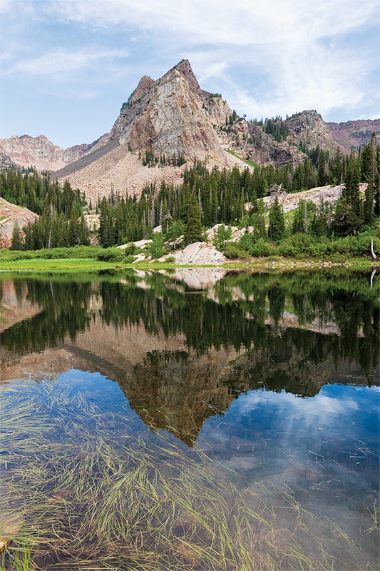
Shingo Ohkawa, buyer for International Mountain Equipment in Salt Lake City and longtime wizard of the Wasatch, calls the routes on Sundial “the finest adventure outings this side of the divide—they require a bit of mountain sense and route-finding, and offer fun, if not thoughtful, climbing in breathtaking situations.” Eleventh Hour climbs steep corners and faces up the North Face of the peak, popping out on top of a 10,320-foot summit surrounded by higher mountains, delivering 360-degree views of the Wasatch.

BETA
Get there: The Mill B South trailhead is 4.4 miles up Big Cottonwood Canyon Road from its intersection with Wasatch Boulevard. Hike the Mill B South Trail three miles to Lake Blanche, heading east around the lake to the base of Sundial. Eleventh Hour begins at the far right of the North Face. Climb the 190-foot first pitch on a broken quartzite face ending at a large ledge; when the follower reaches the ledge, move the belay 50 feet to the right. Climb the face above in a huge left-facing corner to a flat ledge. Above the ledge, follow finger cracks to the exposed arête, staying right of a roof and following the arête to the top. Scramble the south ridge to the summit.
Descent: From the summit, scramble east and down toward a stand of pines. Three single-rope raps (60m is best) from slung trees drop you at the top of the scree on the northeast face. Scramble off the scree back to the trail.
Stay there: USFS Spruces Campground ($22/night, recreation.gov, 877-444-6777)
Guidebook: Rock Climbing the Wasatch Range, by Stuart Ruckman and Brett Ruckman ($35, falcon.com)
West Ridge (5.7, 4 pitches)
Prusik Peak, Cascade Range, Washington
A fun ridge climb on one of the Northwest’s most aesthetic peaks
All most climbers need is a photo of the chiseled arrowhead of Prusik Peak for inspiration—and you’ve probably seen more than a few of Prusik, one of the most photogenic peaks in the Northwest. The West Ridge climbs solid lichen-specked granite slabs, laybacks, and chimneys, keeping the route at mostly 5.5. On the spine of the peak, you’ll get views of the alpine lakes and larch tree–blanketed meadows in both directions all the way up. The first ascent party, Fred Beckey and Art Holben, named the mountain Prusik Peak because their 1948 climb of the East Face required a lasso-and-prusik ascent of the summit horn.

BETA
Get there: From Leavenworth, drive 0.8 miles southwest on Highway 2 and turn left onto Icicle Road. Drive 4.3 miles on Icicle Road to the Snow Lakes trailhead. Hike into a campsite at Lake Viviane (eight miles) or Perfection Lake (nine miles) for an early start in the morning. Head northeast cross-country to the saddle west of Prusik Peak, aiming for a large balanced rock on the West Ridge. Rope up here and stay on the left (north) side of the ridge up to an easy 100-foot dihedral, then follow easy ledges and cracks to the ridge proper. The crux of the climb is a 20-foot friction slab with an old pin for protection (or put in a small nut). After the slab, cruise easy ledges to a squeeze chimney, and then scramble to the summit.
Descent: Four single-rope rappels (60m) or two double-rope rappels down the North Face, and then traverse to Prusik Pass, and back to your campsite (Perfection or Viviane).
Stay there: Before or after the climb, try USFS Eightmile Campground ($16/night, recreation.gov, 877-444-6777).
Guidebook: Selected Climbs in the Cascades: Volume 1, by Jim Nelson and Peter Potterfield ($27, mountaineersbooks.org)
Permits: Required for overnight stays in the Alpine Lakes Wilderness between June 15 and October 15; demand is high for the Enchantments. The 2014 permit lottery began in February at recreation.gov ($6 application fee plus $5 per person per day). Or try for a day-of walk-in permit at the Wenatchee River Ranger District Office at 7:45 a.m. the day of your trip; they give one per day.