Health atlas allows online search of risk by area
- Published

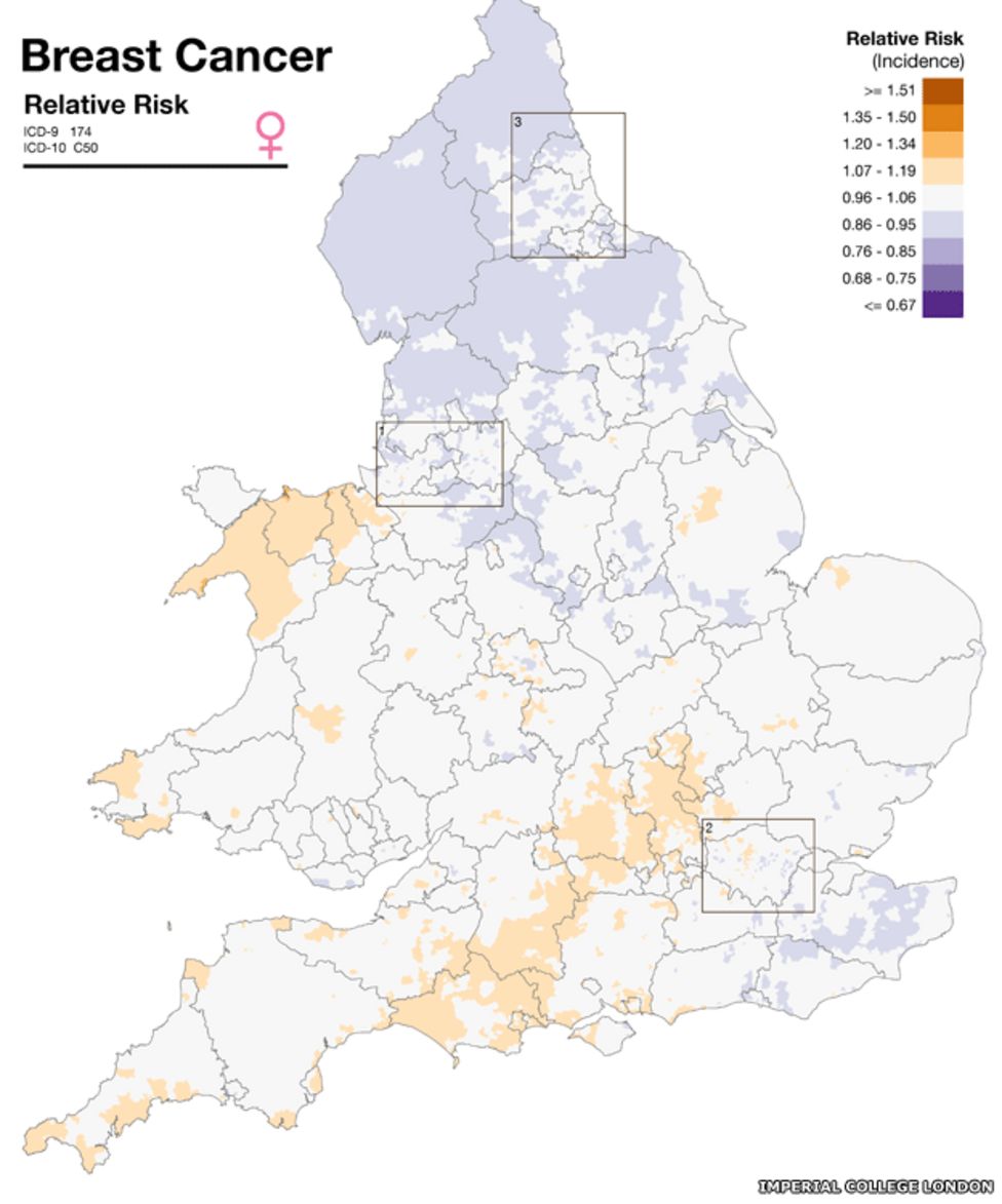
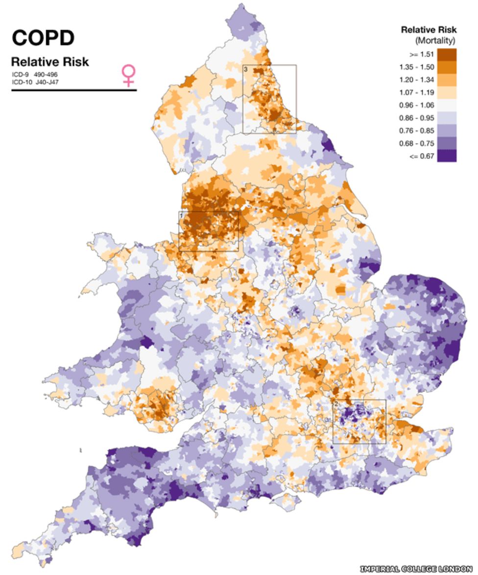
A new online map of England and Wales allows people to enter their postcode and find their community's risk of developing 14 conditions, such as heart disease and lung cancer.
The map presents population-wide health information for England and Wales.
The researchers at Imperial College London pointed out that it could not be used to see an individual's risk.
It indicated an area's health risk, relative to the average for England and Wales, they stressed.
Twenty-five year study
Researchers at Imperial looked at 8,800 wards in England and Wales, each with a population of 6,000 people.
They collected data from the Office for National Statistics and from cancer registries for 1985 to 2009.
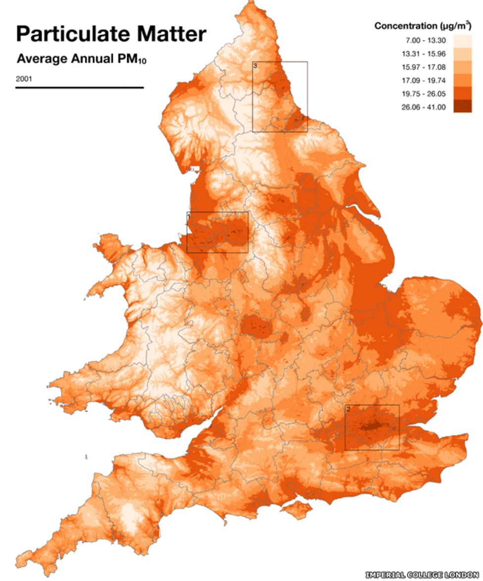
Data was then mapped alongside region-by-region variations in environmental factors such as air pollution, sunshine and pesticides.
The data was also adjusted for age, deprivation and to take into account small numbers.
Researchers said this was the first tool of its kind showing this level of detail.
Dr Anna Hansell, from the UK Small Area Health Statistics Unit, led the research.
She told the BBC: "We tried to present this so people do not jump to the wrong conclusions."
Dr Hansell said people were "fascinated" by the tool when they trialled it.
She added: "The new thing about it is you can go right down to neighbourhood level - beforehand it has been at a broader scale."
Eight communities in Bridgend and Rhondda Cynon Taff, in Wales, and Leeds, Manchester and the Wirral in England had higher patterns of health risks, Dr Hansell said.
She said within those eight communities none stood out as "doing badly for everything", and that the statistics had not been geared up to rank the areas.
Since the study adjusted for deprivation, Dr Hansell said it raised some "surprising" variations which could be explained by changing smoking rates in the past 25 years.
Meanwhile, 33 wards were identified as having a lower risk of disease, such as parts of London, North Norfolk and Suffolk.
Although the researchers adjusted for deprivation, she said, there must be "some lifestyle factors" going on, to account for the variability.
Environmental factors, such as air pollution, accounted for roughly 5-10% of a person's risk of disease, which was significant in terms of a population, Dr Hansell said.
She said she hoped "really important benefits" could come out of further research using the tool and that it would raise questions about disease patterns.
Maps available on the site
Prof David Coggon, professor of occupational and environmental medicine at the University of Southampton, said the atlas provided a "finer level of spatial resolution" than its predecessors.
But he said there were "shortcomings" in the research, such as the possible of chance variation and the likelihood of distortion by exposure to non-environmental causes of disease, such as smoking and diet, which are not fully explained by deprivation.
Prof Coggon added: "These unavoidable shortcomings do not invalidate the analyses presented, but they are a reason for caution in interpretation."
He said people should not focus on environmental factors, but instead eat a healthy diet, exercise regularly and avoid smoking, excessive alcohol, and "unnecessarily risky" behaviours such as dangerous driving.
Prof Paul Pharoah, professor of cancer epidemiology at the University of Cambridge, said: "This atlas does not enable anyone to judge their individual absolute risk.
"People should definitely not use this atlas to decide where to live."
He said it would be "wrong to imply" any causal association between any of the environmental exposures and any of the health outcomes described in the atlas.
Prof Pharoah added: "What these data should do is help researchers identify important hypothesis that should be tested using research designs."
- Published21 April 2014

- Published9 March 2014

- Published14 June 2013